Skip past header information
USGS - science for a changing world

U.S. Geological Survey Open-File Report 2011-1041

Continuous Resistivity Profiling Data from Northport Harbor and Manhasset Bay, Long Island, New York


Skip past navigation menu to main text Title Page / List of Figures / Conversion Factors / Acronyms / Abstract / Introduction / Methods / Profile Previews / Summary / Data Catalog / Acknowledgments / References Cited / Glossary


Figure 1, map of Long Island, New York indicating glacial features.
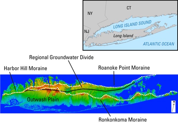
Figure 1. Map of Long Island, New York, indicating glacial features on the island. The base image was acquired from Stony Brook University(http://www.geo.sunysb.edu/reports/dem_2/), accessed June 2011.
Skip USGS links group

Accessibility FOIA Privacy Policies and Notices

Take Pride in America logo USAGov logo U.S. Department of the Interior | U.S. Geological Survey
End of USGS links group