U.S. Geological Survey Open-File Report 2011-1127
|
By Erin R. Twomey and Richard P. Signell 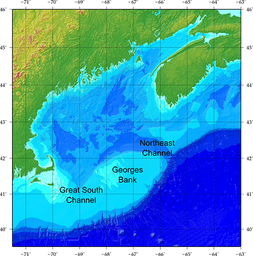 A shaded-relief image representing the extent of the 3-arcsecond digital elevation model for the Gulf of Maine (71°30' to 63°W, 39°30' to 46°N). U.S. Department of the Interior U.S. Geological Survey U.S. Geological Survey, Reston, Virginia: 2013
For product and ordering information:
For more information on the USGS—the Federal source for science about the Earth, its natural and living resources, natural hazards, and the environment:
Suggested citation:
Any use of trade, product, or firm names is for descriptive purposes only and does not imply endorsement by the U.S. Government.
Although this report is in the public domain, permission must be secured from the individual copyright owners to reproduce any copyrighted material contained within this report. |


