Skip Links

USGS - science for a changing world

Open-File Report Series 2012–1003

Apalachicola Bay Interpreted Seismic Horizons and Updated IRIS Chirp Seismic-Reflection Data

By V.A. Cross, D.C. Twichell, D.S. Foster, and T.F. O'Brien

Thumbnail of report and link to Title PageAbstract

Apalachicola Bay and St. George Sound contain the largest oyster fishery in Florida, and the growth and distribution of the numerous oyster reefs here are the combined product of modern estuarine conditions and the late Holocene evolution of the bay. A suite of geophysical data and cores were collected during a cooperative study by the U.S. Geological Survey, the National Oceanic and Atmospheric Administration Coastal Services Center, and the Apalachicola National Estuarine Research Reserve to refine the geology of the bay floor as well as the bay’s Holocene stratigraphy. Sidescan-sonar imagery, bathymetry, high-resolution seismic profiles, and cores show that oyster reefs occupy the crests of sandy shoals that range from 1 to 7 kilometers in length, while most of the remainder of the bay floor is covered by mud. The sandy shoals are the surficial expression of broader sand deposits associated with deltas that advanced southward into the bay between 6,400 and 4,400 years before present. The seismic and core data indicate that the extent of oyster reefs was greatest between 2,400 and 1,200 years before present and has decreased since then due to the continued input of mud to the bay by the Apalachicola River. The association of oyster reefs with the middle to late Holocene sandy delta deposits indicates that the present distribution of oyster beds is controlled in part by the geologic evolution of the estuary.

First posted June 11, 2012

For additional information contact:
Director
U.S. Geological Survey
Woods Hole Coastal and Marine Science Center
384 Woods Hole Road
Quissett Campus
Woods Hole, MA 02543
(508) 548–8700
woodshole.er.usgs.gov

Part or all of this report is presented in Portable Document Format (PDF); the latest version of Adobe Reader or similar software is required to view it. Download the latest version of Adobe Reader, free of charge.


Suggested citation:

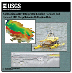
Cross, V.A., Twichell, D.C., Foster, D.S., and O'Brien, T.F., 2012, Apalachicola Bay interpreted seismic horizons and updated IRIS chirp seismic-reflection data: U.S. Geological Survey Open-File Report 2012–1003, at http://pubs.usgs.gov/of/2012/1003/.


Accessibility FOIA Privacy Policies and Notices

Take Pride in America logo USA.gov logo U.S. Department of the Interior | U.S. Geological Survey
URL: http://pubsdata.usgs.gov/pubs/of/2012/1003/index.html
Page Contact Information: GS Pubs Web Contact
Page Last Modified: Saturday, 12-Jan-2013 15:16:56 EST