Skip past header information
USGS - science for a changing world

U.S. Geological Survey Open-File Report 2012-1003

Apalachicola Bay Interpreted Seismic Horizons and Updated IRIS Chirp Seismic-Reflection Data


Skip past navigation menu to main text Title Page / List of Figures / Conversion Factors / Abstract / Overview / Methods / Profile Previews / Data Catalog / Acknowledgments / References Cited


Figure 5, map showing the contact between the base of the modern mud deposit and the underlying deposits.
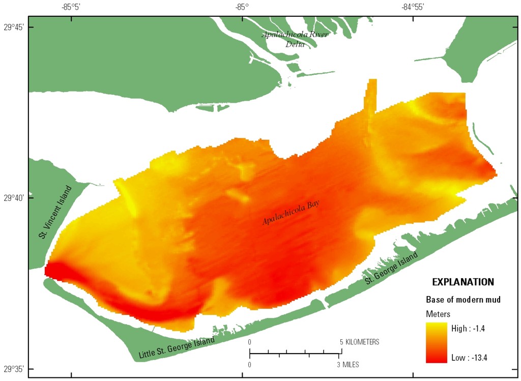
Figure 5. Map showing the contact between the base of the modern mud deposit and the underlying middle Holocene estuarine and deltaic deposits in Apalachicola Bay. Click on image for larger version.
Skip USGS links group

Accessibility FOIA Privacy Policies and Notices

Take Pride in America logo USAGov logo U.S. Department of the Interior | U.S. Geological Survey
End of USGS links group