U.S. Geological Survey Open-File Report 2012–1004
Sea-Floor Geology in Central Rhode Island Sound South of Sakonnet Point, Rhode Island
![]() Title |
List of Figures |
Conversion Factors |
Abstract |
Introduction |
Setting |
Methods |
Bathymetry |
Sediments |
Bottom Photography |
GIS Data Catalog |
Summary |
Acknowledgments |
References |
Contacts
Title |
List of Figures |
Conversion Factors |
Abstract |
Introduction |
Setting |
Methods |
Bathymetry |
Sediments |
Bottom Photography |
GIS Data Catalog |
Summary |
Acknowledgments |
References |
Contacts
 |
||
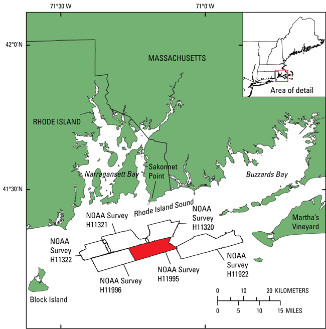
Figure 1. Location of National Oceanic and Atmospheric Administration (NOAA) Survey H11995 study area (red polygon) in relation to other NOAA surveys in Rhode Island Sound that have been interpreted as part of this series of reports including: H11320 (McMullen and others, 2007), H11321 (McMullen and others, 2008), H11322 (McMullen and others, 2009), H11922 (Poppe and others, 2011), and H11996 (McMullen and others, 2011). |
||


