 Abstract
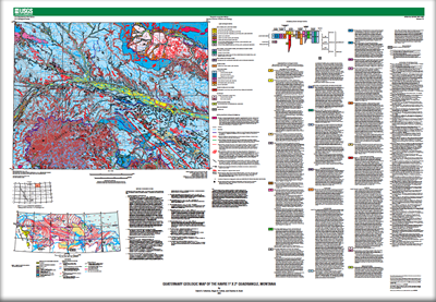
The Havre quadrangle encompasses approximately 16,084 km2 (6,210 mi2). The northern boundary is the Montana/Saskatchewan (U.S./Canada) boundary. The quadrangle is in the Northern Plains physiographic province and it includes parts of the Bearpaw Mountains, the Little Rocky Mountains, and the Boundary Plateau. The primary river is the Milk River. The ancestral Missouri River was diverted south of the Bearpaw Mountains by a Laurentide ice sheet. The fill in the buried ancestral valley at and southwest of Havre contains a complex stratigraphy of fluvial, glaciofluvial, ice-contact, glacial, lacustrine, and eolian deposits. The old valley east of Havre now is occupied by the Milk River.
The map units are surficial deposits and materials, not landforms. Deposits that comprise some constructional landforms (e.g., ground-moraine deposits, end-moraine deposits, stagnation-moraine deposits, all composed of till) are distinguished for purposes of reconstruction of glacial history. Surficial deposits and materials are assigned to 24 map units on the basis of genesis, age, lithology or composition, texture or particle size, and other physical, chemical, and engineering characteristics. It is not a map of soils that are recognized in engineering geology, or of substrata or parent materials in which pedologic or agronomic soils are formed. Glaciotectonic (ice-thrust) structures and deposits are mapped separately, represented by a symbol. On the glaciated plains and on the Boundary Plateau the surficial deposits are glacial, ice-contact, glaciofluvial, catastrophic flood, alluvial, lacustrine, eolian, and colluvial deposits. In the Bearpaw Mountains and Little Rocky Mountains beyond the limit of Quaternary glaciation they are fluvial, colluvial, and mass-wasting deposits and residual materials.
Tills of late Wisconsin and Illinoian ages are represented by map units. Tills of two pre-Illinoian glaciations are not mapped but are widespread in the subsurface and are identified in stratigraphic sections. Thirteen stratigraphic sections document a complex glacial and interglacial history in the quadrangle. Pliocene continental glaciation possibly is represented by erratic blocks of garnet gneiss and pegmatite from the Canadian Shield, perched high on drainage divides in the western Bearpaw Mountains. Glacial striations on bedrock, two boulder trains, and linear ice-molded landforms (primarily drumlins) indicate the possible presence of an east-southeast flowing ice stream in the Havre glacial lobe during late Wisconsin glaciation.

