Skip Links

USGS - science for a changing world

Open-File Report 2012–1109

Introduction to Geospatial Semantics and Technology Workshop Handbook

Edited by Dalia E. Varanka

Thumbnail of and link to report PDF (3.21 MB)Abstract

The workshop is a tutorial on introductory geospatial semantics with hands-on exercises using standard Web browsers. The workshop is divided into two sections, general semantics on the Web and specific examples of geospatial semantics using data from The National Map of the U.S. Geological Survey and the Open Ontology Repository. The general semantics section includes information and access to publicly available semantic archives. The specific session includes information on geospatial semantics with access to semantically enhanced data for hydrography, transportation, boundaries, and names. The Open Ontology Repository offers open-source ontologies for public use.

Revised November 9, 2012

First posted May 30, 2012

For additional information contact:
Director, USGS Center of Excellence for Geospatial Information
Science (CEGIS)
1400 Independence Road
Rolla, MO 65401
http://cegis.usgs.gov/

Part or all of this report is presented in Portable Document Format (PDF); the latest version of Adobe Reader or similar software is required to view it. Download the latest version of Adobe Reader, free of charge.


Suggested citation:

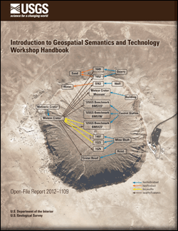
Varanka, D.E., ed., 2012, Introduction to geospatial semantics and technology workshop handbook: U.S. Geological Survey Open-File Report 2012–1109, 107 p. (Revised November 2012)


Contents

Workshop Agenda

Workshop Summary and Slides

Internet Resources

Blogs

Suggested Literature

Terrain

Workshop Review


Accessibility FOIA Privacy Policies and Notices

Take Pride in America logo USA.gov logo U.S. Department of the Interior | U.S. Geological Survey
URL: http://pubsdata.usgs.gov/pubs/of/2012/1109/index.html
Page Contact Information: GS Pubs Web Contact
Page Last Modified: Saturday, 12-Jan-2013 15:14:51 EST