Open-File Report 2012–1157
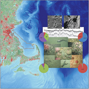
AbstractThe Massachusetts inner continental shelf between Nahant and northern Cape Cod Bay has been profoundly affected by the occupation and retreat of glacial ice sheets and relative sea-level change during the Quaternary. Marine geologic mapping of this area is a component of a statewide cooperative effort involving the U.S. Geological Survey and the Massachusetts Office of Coastal Zone Management. Interpretation of high-resolution geophysical data (interferometric and multibeam swath bathymetry, lidar, backscatter, and seismic reflection), sediment samples, and bottom photographs was used to produce a series of maps that describe the distribution and texture of seafloor sediments, shallow geologic framework, and physiographic zones of this inner-shelf region. These data and interpretations are intended to aid efforts to inventory and manage coastal and marine resources, and provide baseline information for research focused on coastal evolution and environmental change. |
First posted August 22, 2013
For additional information contact: Part or all of this report is presented in Portable Document Format (PDF); the latest version of Adobe Reader or similar software is required to view it. Download the latest version of Adobe Reader, free of charge. |
Pendleton, E.A., Baldwin, W.E., Barnhardt, W.A., Ackerman, S.D., Foster, D.S., Andrews, B.D., and Schwab, W.C., 2013, Shallow geology, seafloor texture, and physiographic zones of the Inner Continental Shelf from Nahant to northern Cape Cod Bay, Massachusetts: U.S. Geological Survey Open-File Report 2012–1157, 53 p., http://pubs.usgs.gov/of/2012/1157/.
Abstract
Introduction
Methods
Results
Discussion
Summary
Acknowledgments
References Cited
Appendix 1—Geospatial Data

![]() U.S. Department of the Interior |
U.S. Geological Survey
U.S. Department of the Interior |
U.S. Geological Survey
URL: http://pubsdata.usgs.gov/pubs/of/2012/1157/index.html
Page Contact Information: GS Pubs Web Contact
Page Last Modified: Friday, 23-Aug-2013 14:28:06 EDT
