U.S. Geological Survey Open-File Report 2012-1157
Shallow Geology, Seafloor Texture, and Physiographic Zones of the Inner Continental Shelf from Nahant to Northern Cape Cod Bay, Massachusetts
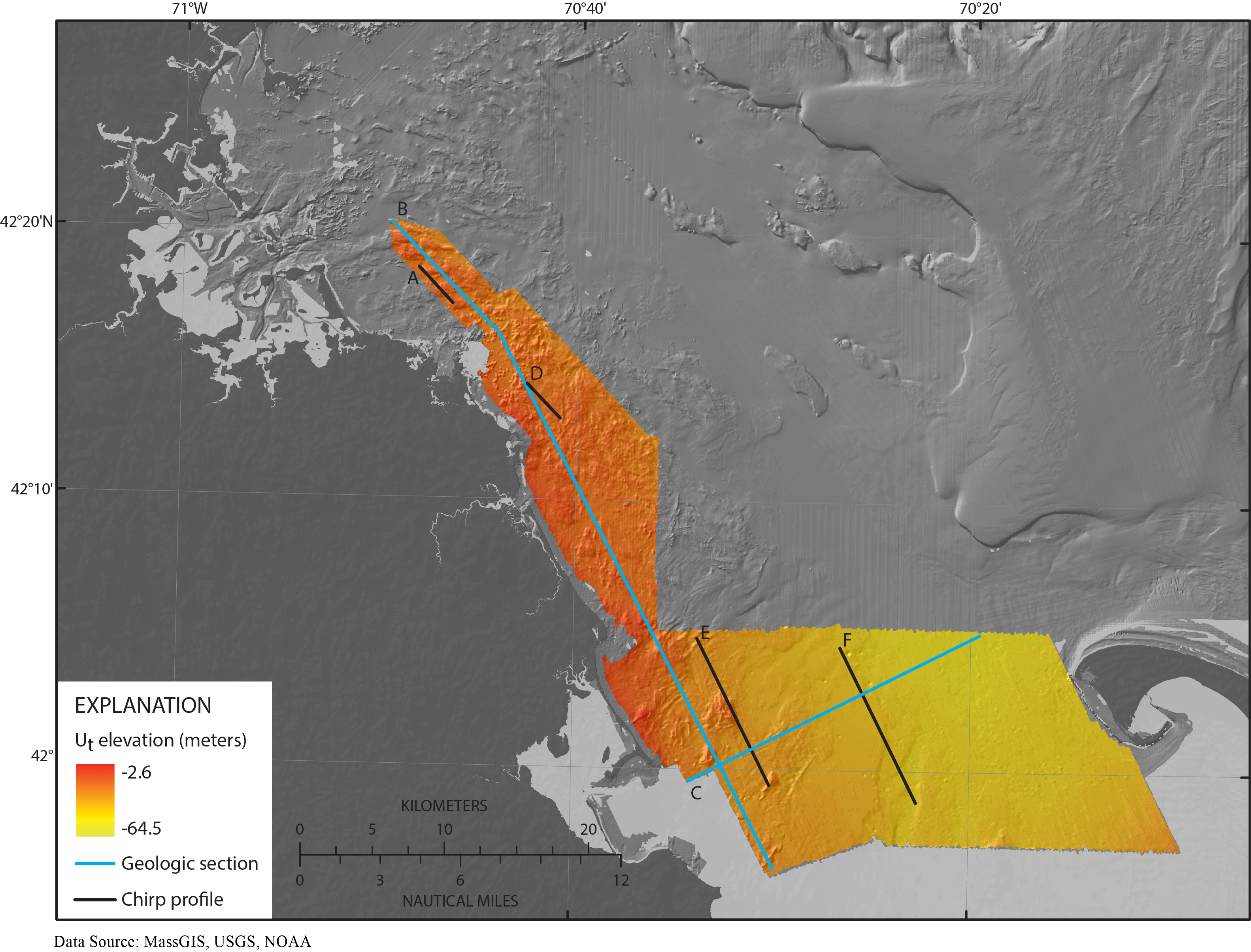
Figure 24. Map showing the elevation (from the North American Vertical Datum of 1988) of the Holocene transgressive unconformity Ut, which identifies the truncated surface of Holocene fluvial and estuarine (Qfe) sediments and older adjacent units beneath the Massachusetts inner shelf between Nahant and northern Cape Cod Bay. Ut represents a composite unconformity where it locally merges with the oldest fluvial (U1) unconformity, the late Wisconsinan regressive (Ut) unconformity, or both (fig. 7). The locations of geologic cross sections B-B' and C-C' (fig. 8) are indicated by cyan lines, and the locations of chirp seismic-reflection profiles A-A', D-D', E-E', and F-F' are indicated by black lines.

![]() U.S. Department of the Interior |
U.S. Geological Survey
U.S. Department of the Interior |
U.S. Geological Survey
URL: http://pubsdata.usgs.gov/pubs/of/2012/1157/html/imagepages/Figure24.html
Page Contact Information: GS Pubs Web Contact
Page Last Modified: Tuesday, 20-Aug-2013 12:07:09 EDT
