Open-File Report 2013–1088
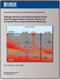
AbstractThe installation of drainage canals, poorly cased wells, and water-supply withdrawals have led to saltwater intrusion in the primary water-use aquifers in southwest Florida. Increasing population and water use have exacerbated this problem. Installation of water-control structures, well-plugging projects, and regulation of water use have slowed saltwater intrusion, but the chloride concentration of samples from some of the monitoring wells in this area indicates that saltwater intrusion continues to occur. In addition, rising sea level could increase the rate and extent of saltwater intrusion. The existing saltwater intrusion monitoring network was examined and found to lack the necessary organization, spatial distribution, and design to properly evaluate saltwater intrusion. The most recent hydrogeologic framework of southwest Florida indicates that some wells may be open to multiple aquifers or have an incorrect aquifer designation. Some of the sampling methods being used could result in poor-quality data. Some older wells are badly corroded, obstructed, or damaged and may not yield useable samples. Saltwater in some of the canals is in close proximity to coastal well fields. In some instances, saltwater occasionally occurs upstream from coastal salinity control structures. These factors lead to an incomplete understanding of the extent and threat of saltwater intrusion in southwest Florida. A proposed plan to improve the saltwater intrusion monitoring network in the South Florida Water Management District’s Big Cypress Basin describes improvements in (1) network management, (2) quality assurance, (3) documentation, (4) training, and (5) data accessibility. The plan describes improvements to hydrostratigraphic and geospatial network coverage that can be accomplished using additional monitoring, surface geophysical surveys, and borehole geophysical logging. Sampling methods and improvements to monitoring well design are described in detail. Geochemical analyses that provide insights concerning the sources of saltwater in the aquifers are described. The requirement to abandon inactive wells is discussed. |
First posted May 20, 2013
For additional information contact: Part or all of this report is presented in Portable Document Format (PDF); the latest version of Adobe Reader or similar software is required to view it. Download the latest version of Adobe Reader, free of charge. |
Prinos, S.T., 2013, Saltwater intrusion in the surficial aquifer system of the Big Cypress Basin, southwest Florida, and a proposed plan for improved salinity monitoring: U.S. Geological Survey Open-File Report 2013–1088, 58 p., http://pubs.usgs.gov/of/2013/1088/.
Abstract
Introduction
Saltwater Intrusion in South Florida
Joint Saltwater Intrusion Monitoring Network Description and Examination
Analysis of Monitoring and Development of a Saltwater Intrusion Monitoring Network Improvement Plan
Prioritization of Network Improvements
Summary
Acknowledgments
Selected References

![]() U.S. Department of the Interior |
U.S. Geological Survey
U.S. Department of the Interior |
U.S. Geological Survey
URL: http://pubsdata.usgs.gov/pubs/of/2013/1088/index.html
Page Contact Information: GS Pubs Web Contact
Page Last Modified: Monday, 20-May-2013 11:04:55 EDT
