U.S. Geological Survey Open-File Report 2013-1284
Shapefile for Coastal Zone Management Program Counties of the United States and Territories, 2009 (CZMP_counties_2009.shp)
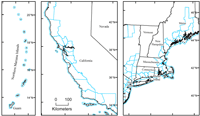
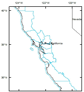
Ideally, polygons for CZMP counties would include the offshore part of the coastal zone. The U.S. Census Bureau MAF/TIGER database is the best source of spatial data approximating this ideal: TIGER/Line shapefiles extracted from this database depict counties extending offshore to the traditional 3-nautical-mile limit, which for most states and territories nearly coincides with the Submerged Lands Act boundary. The U.S. Census Bureau clarified this point in a written communication to one of the authors: “Our 3-mile limit does not represent any sort of formal legal or administrative boundary and is not intended to define official limits for Federal programs or legal disputes even though it is often very similar to the Submerged Lands Act boundary. In most areas, our 3-mile limit is… similar (but not identical) to the old limit of the United States’ territorial waters (before the limit of territorial waters changed from 3 to 12 nautical miles in 1988). While our 3-mile limit has not been substantially modified since the creation of our TIGER Database, we are currently looking into possible modifications/improvements for the future to make it more consistent with other Federal limits” (Geographic Products Branch, Geography Division, U.S. Census Bureau, written commun., June 13, 2011). Given our purpose in compiling a shapefile of CZMP counties—to facilitate the search and retrieval of georeferenced information resources related to the coastal zone—the MAF/TIGER database provides polygons suitable for systems that permit users to search irregular geographic areas; however, if the USGS shapefile of CZMP counties is used for other purposes (for example, as a display layer in a geographic information system), the U.S. Census Bureau caveat concerning Federal offshore limits must be kept in mind. The polygon shapefile includes CZMP counties and equivalent entities from the 30 states and 5 U.S. territories—American Samoa, Guam, the Northern Mariana Islands, Puerto Rico, and the U.S. Virgin Islands—participating in the program in 2009 (selected areas are shown in fig. 1). Alaska subsequently withdrew from the CZMP but is included in the shapefile for reasons explained in the Data Sources section; however, several island territories are not included in the shapefile because they have never participated in the CZMP. The polygon shapefile is in unprojected geographic coordinates (decimal degrees) with the North American Datum of 1983 (NAD 83) as the horizontal datum (from the TIGER/Line shapefile). The geographic extent of the shapefile to the nearest 15 minutes (quarter degree) is 141°00’ E to 64°30’ W longitude and 14°45’ S to 71°30’ N latitude.
|