Open File Report 2014–1094
Maps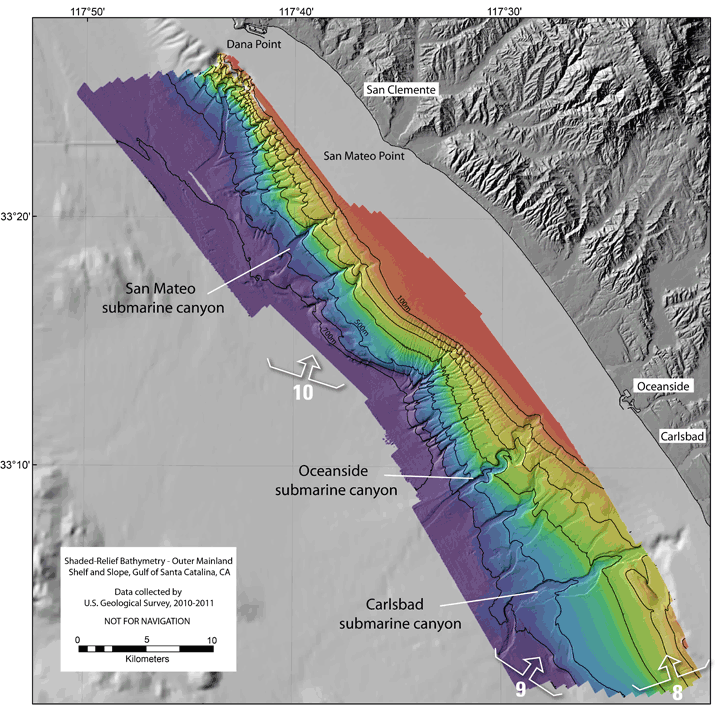
Shaded-relief bathymetry of the outer mainland shelf and slope, Gulf of Santa Catalina, CA. The colored shaded relief bathymetry is from the 2010 and 2011 USGS mapping available in this report. Numbered arrows show viewing directions of perspective views in report (Figures 8-10). 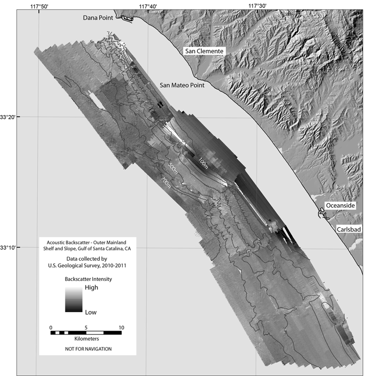
Acoustic backscatter of the outer mainland shelf and slope, Gulf of Santa Catalina, CA. Imagery is from the 2010 and 2011 USGS mapping available in this report. |
First posted May 16, 2014 For additional information, contact: Part or all of this report is presented in Portable Document Format (PDF). For best results viewing and printing PDF documents, it is recommended that you download the documents to your computer and open them with Adobe Reader. PDF documents opened from your browser may not display or print as intended. Download the latest version of Adobe Reader, free of charge. |

![]() U.S. Department of the Interior |
U.S. Geological Survey
U.S. Department of the Interior |
U.S. Geological Survey
URL: http://pubsdata.usgs.gov/pubs/of/2014/1094/maps.html
Page Contact Information: GS Pubs Web Contact
Page Last Modified: Wednesday, 07-Dec-2016 19:35:51 EST
