Open-File Report 2014–1238
|
First posted January 15, 2015 For additional information, contact: Part or all of this report is presented in Portable Document Format (PDF). For best results viewing and printing PDF documents, it is recommended that you download the documents to your computer and open them with Adobe Reader. PDF documents opened from your browser may not display or print as intended. Download the latest version of Adobe Reader, free of charge. More information about viewing, downloading, and printing report files can be found here. |
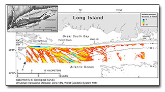
Schwab, W.C., Baldwin, W.E., and Denny, J.F., 2014, Maps showing the change in modern sediment thickness on the Inner Continental Shelf Offshore of Fire Island, New York, between 1996–97 and 2011: U.S. Geological Survey Open-File Report 2014–1238, https://dx.doi.org/10.3133/ofr20141238.
ISSN 2331–1258 (online)
Abstract
Introduction
Geologic Setting
Methods
Mapping Results
Acknowledgments
References Cited

![]() U.S. Department of the Interior |
U.S. Geological Survey
U.S. Department of the Interior |
U.S. Geological Survey
URL: http://pubsdata.usgs.gov/pubs/of/2014/1238/index.html
Page Contact Information: GS Pubs Web Contact
Page Last Modified: Wednesday, 07-Dec-2016 20:05:12 EST