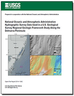
 Abstract Abstract
The U.S. Geological Survey initiated a research effort in 2014 to define the geologic framework of the Delmarva Peninsula inner continental shelf, which included new data collection and assembly of relevant extant datasets. Between 2006 and 2011, Science Applications International Corporation, under contract to the National Oceanic and Atmospheric Administration National Ocean Service, carried out 23 hydrographic surveys covering more than 4,100 square kilometers of the continental shelf using Reson multibeam echosounders and Klein towed sidescan sonars to update nautical charts along the Delmarva Peninsula. Acoustic backscatter data from these instruments are valuable for characterizing aspects of shallow geologic framework, including seafloor geology, sediment transport pathways, and marine resources. The data cover an area that extends from the entrance of Delaware Bay, Delaware, south to Parramore Island, Virginia, in water depths of about 3 to 35 meters below mean lower low water. Data were collected along lines spaced 40 meters apart, resulting in 40 to 100 percent seafloor coverage for multibeam bathymetry. Processed bathymetric data within the Delmarva Peninsula study area are available through a National Ocean Service interactive map interface, but towed sidescan data products are limited, and multibeam backscatter data products have not been available in the past.
The U.S. Geological Survey obtained raw Reson multibeam data files from Science Applications International Corporation and the National Oceanic and Atmospheric Administration for 20 hydrographic surveys and extracted backscatter data using the Fledermaus Geocoder Toolbox from Quality Positioning Service. The backscatter mosaics produced by the U.S. Geological Survey for the inner continental shelf of the Delmarva Peninsula using National Oceanic and Atmospheric Administration data increased regional geophysical surveying efficiency, collaboration among government agencies, and the area over which geologic data can be interpreted by the U.S. Geological Survey. This report describes the methods by which the backscatter data were extracted and processed and includes backscatter mosaics and interpolated bathymetric surfaces.
|
First posted December 30, 2014
- Downloads Directory
Contains: multibeam backscatter images, bathymetric surface in geographic information system grid format and metadata, and hillshaded relief image for bathymetirc grid. Refer to the Readme file for more information.
Part or all of this report is presented in Portable Document Format (PDF). For best results viewing and printing PDF documents, it is recommended that you download the documents to your computer and open them with Adobe Reader. PDF documents opened from your browser may not display or print as intended. Download the latest version of Adobe Reader, free of charge. More information about viewing, downloading, and printing report files can be found here.
|

