 Introduction Introduction
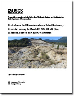
During the late morning of March 22, 2014, a devastating landslide occurred near the town of Oso, Washington. The landslide with an estimated volume of 10.9 million cubic yards (8.3 ×10⁶ m3) of both intact glacially deposited and previously disturbed landslide sediments, reached speeds averaging 40 miles per hour (64 kilometers per hour) and crossed the entire 2/3-mile (~1100 m) width of the adjacent North Fork Stillaguamish River floodplain in approximately 60 seconds, resulting in the complete destruction of an entire neighborhood (Iverson and others, 2015). More than 40 homes were destroyed as the debris overran the neighborhood, resulting in the deaths of 43 people.
Landslides in glacial deposits are common in the Pacific Northwest (for example, Baum and others, 2008), and in fact, the site of the March 22, 2014 SR-530 landslide had experienced significant reactivation several times in past decades, with the most recent event occurring in 2006 (for example, Miller and Sias, 1998). However, these previous landslides were of considerably less volume and mobility (Iverson and others, 2015), and debris had never reached the Steelhead Haven neighborhood. Further, no landslides with the type of mobility that the March 22, 2014 landslide underwent have been recorded in historic times within the North Fork Stillaguamish River valley. However, mapping performed immediately following the landslide indicates that several other slopes in the North Fork Stillaguamish River valley have experienced large-volume landslides exhibiting high mobility in prehistoric times (Haugerud, 2014). The presence of previous high-mobility landslides in the valley, and the now well-documented occurrence of one involving many fatalities, underscores both the hazard and risk for those that live and travel in this and other river valleys in the Pacific Northwest with similar glacial deposits and precipitation patterns.
To understand the hazards posed by highly mobile landslides in the Pacific Northwest, the U.S. Geological Survey (USGS), together with its project partners, the University of California, Berkeley Department of Civil and Environmental Engineering (UCB), and the Washington State Department of Transportation (WSDOT), is undertaking a critically needed study to identify the geologic, hydrogeologic, and geotechnical conditions in which these large landslides initiate, as well as the processes responsible for the exceptional mobility of this, and potentially other, landslides in the region. One of the first study activities involves characterizing the stratigraphy and materials from which the landslide deposits are derived, so that the fundamental geotechnical nature of the soils can be understood. This understanding is required to begin identifying possible conditions leading to slope failure and their relation to the landslide’s high mobility. In addition, detailed characterization of each stratigraphic unit encountered in initial geotechnical borings is needed to relate stratigraphy between borings for this study and as a part of ongoing investigations by WSDOT and other project partners.
This report provides a description of the methods used to obtain and test the intact soil stratigraphy behind the headscarp of the March 22 landslide. Detailed geotechnical index testing results are presented for 24 soil samples representing the stratigraphy at 19 different depths along a 650 ft (198 m) soil profile. The results include (1) the soil’s in situ water content and unit weight (where applicable); (2) specific gravity of soil solids; and (3) each sample’s grain-size distribution, critical limits for fine-grain water content states (that is, the Atterberg limits), and official Unified Soil Classification System (USCS) designation. In addition, preliminary stratigraphy and geotechnical relations within and between soil units are presented.
|
First posted May 22, 2015
Part or all of this report is presented in Portable Document Format (PDF). For best results viewing and printing PDF documents, it is recommended that you download the documents to your computer and open them with Adobe Reader. PDF documents opened from your browser may not display or print as intended. Download the latest version of Adobe Reader, free of charge. More information about viewing, downloading, and printing report files can be found here.
|

