Open-File Report 2015–1118
The data were compiled in ArcMap (version 10.2). Raster data layers are georeferenced GeoTIFF images and are in the UTM Zone 10 coordinate system, referenced to World Geodetic system 1984. Line features are in shapefile format and are unprojected geographic coordinates, referenced to World Geodetic system 1984. Users should create a single new folder within which to unzip the files.
Theme |
Preview |
File format | Metadata |
Download** |
File Size |
|---|---|---|---|---|---|
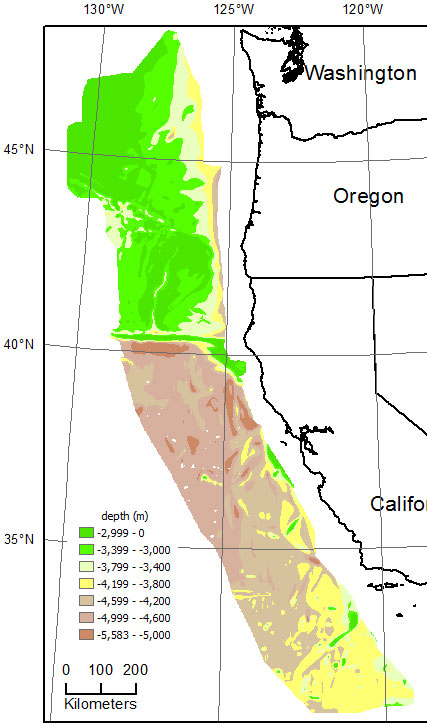
Sediment-thickness contours |
|
line shapefile | 717 kB | ||
Sediment-thickness grid |
|
geotiff | 3.2 MB | ||
Depth-to-basement contours |
|
line shapefile | 775 kB | ||
Depth-to-basement grid |
|
geotiff | 3.1 MB | ||
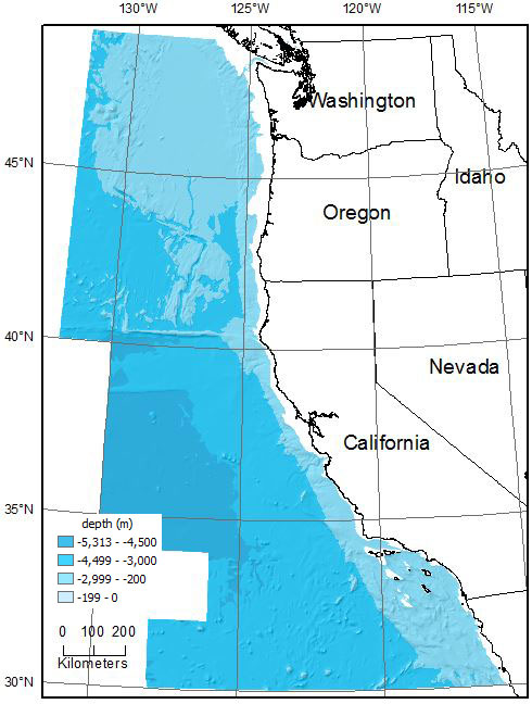
Bathymetry contours |
|
line shapefile | 6.9 MB | ||
Bathymetry grid |
|
geotiff | 7.0 MB |
** The downloadable data files have been compressed with Windows7 folder menu > Send to > Compressed (zipped) folder, and can be unzipped with Winzip (or other similar tool) on Windows systems. The bathymetry raster zip file, for example, contains
cowbatg.jpg — browse image,
cowbatg.tfw — image-to-world transformation parameters,
cowbatg.tif — raster in geotiff format,
cowbatg.tif.aux.xml — auxiliary information for the raster file, such as projection, statistics, pointer to pyramid file (if present), etc.,
cowbatg.tif.met — metadata for raster in text format,
cowbatg.tif.ovr — raster pyramid file,
cowbatg.tif.xml — metadata for raster in .xml format, and
cowbatg_tif.lyr — paramenters for rendering raster in Arcmap
As an example of the shapefile package, the bathymetry shapefile zip includes
cowbat.dbf — dBASE table that stores the attribute information of features,
cowbat.jpg — browse image,
cowbat.prj — coordinate system information,
cowbat.sbn — spatial index of the features,
cowbat.sbx — spatial index of the features,
cowbat.shp — feature geometry,
cowbat.shx — index of the feature geometry,
cowbathy.shp.met — metadata in plain text,
cowbathy.shp.xml — metadata in XML code, and
cowbat_shp.lyr — parameters for rendering shapefile in Arcmap
Return to OF 2015-1118 index page

![]() U.S. Department of the Interior |
U.S. Geological Survey
U.S. Department of the Interior |
U.S. Geological Survey
URL: http://pubsdata.usgs.gov/pubs/of/2015/1118/data_catalog.html
Page Contact Information: GS Pubs Web Contact
Page Last Modified: Wednesday, 07-Dec-2016 21:43:02 EST