
| This is a cover page. To go to the actual document, click on the title above. |
| The document is in PDF format (1.1 MB). You will need Acrobat Reader to view and print. If you do not have Acrobat Reader, you will need to download the program. |
| Click here to Download Adobe Acrobat 3.0 and follow the download and installation instructions provided. After downloading Acrobat, configure your browser to use Acrobat as a helper application. |
In 1996, seven cores were recovered in western Collier County, southwestern Florida, to acquire subsurface geologic and hydrologic data to support ground-water modeling efforts. This report presents the lithostratigraphy, X-ray diffraction analyses, petrography, biostratigraphy, and strontium-isotope stratigraphy of these cores.
The oldest unit encountered in the study cores is an unnamed formation that is late Miocene. At least four depositional sequences are present within this formation. Calculated age of the formation, based on strontium-isotope stratigraphy, ranges from 9.5 to 5.7 Ma (million years ago). An unconformity within this formation that represents a hiatus of at least 2 million years is indicated in the Old Pump Road core. In two cores, Collier-Seminole and Old Pump Road, the uppermost sediments of the unnamed formation are not dated by strontium isotopes, and, based on the fossils present, these sediments could be as young as Pliocene. In another core (Fakahatchee Strand-Ranger Station), the upper part of the unnamed formation is dated by mollusks as Pliocene.
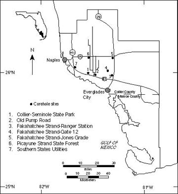 Map of Collier and Monroe Counties, southwestern Florida, showing locations of the corehole sites.
The Tamiami Formation overlies the unnamed formation throughout the study area and is represented by the Ochopee Limestone Member. The unit is Pliocene and probably includes the interval of time near the early/late Pliocene boundary. Strontium-isotope analysis indicates an early Pliocene age (calculated ages range from 5.1 to 3.5 Ma), but the margin of error includes the latest Miocene and the late Pliocene. The dinocyst assemblages in the Ochopee typically are not age-diagnostic, but, near the base of the unit in the Collier-Seminole, Jones Grade, and Fakahatchee Strand State Forest cores, they indicate an age of late Miocene or Pliocene. The molluscan assemblages indicate a Pliocene age for the Ochopee, and a distinctive assemblage of Carditimera arata ? and Chione cortinaria ? in several of the cores specifically indicates an age near the early/late Pliocene boundary.
Undifferentiated sands overlie the Pliocene limestones in two cores in the southern part of the study area. Artificial fill occurs at the top of most of the cores.
The hydrologic confining units penetrated by these cores are different in different parts of the study area. To the west, a hard tightly cemented dolostone forms the first major confining unit below the water table. In the eastern part of the study area, confinement is more difficult to determine. A tightly cemented sandstone, much younger than the dolostones to the west and probably not laterally connected to them, forms a slight confining unit in one core. Thick zones of poorly sorted muddy unconsolidated sands form a slight confining unit in other cores; these probably are not correlative to either the sandstone or the dolostones to the west. The age and sedimentologic observations suggest a complex compartmentalization of the surficial aquifer system in southwestern Florida. The calibrations of dinocyst and molluscan occurrences with strontium-isotope stratigraphy allows us to expand and document the reported ranges of many taxa.
This report is preliminary and has not been reviewed for conformity with U.S. Geological Survey editorial standards or with the North American Stratigraphic Code. Any use of trade, product, or firm names is for descriptive purposes only and does not imply endorsement by the U.S. Government.
|
Information for ordering U.S. Geological Survey maps and reports is available by calling 1-888-ASK-USGS. Information for ordering USGS products also is available from the USGS home page on the World Wide Web at URL http://www.usgs.gov/. You can write to
USGS Information Services Fax: 303-202-4695
|
Return to Geologic Mapping and Regional Geologic Studies in the Eastern United States
Return to Open-File Reports
Return to Geologic Information