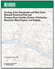
Professional Paper 1691
1 U.S. Geological Survey, Reston, VA 20192.
2 Maryland Geological Survey, Baltimore, MD 21218.
PDF Professional Paper 1691, body only (59 MB, 154 pages)
|
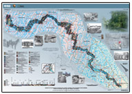
AbstractThe Chesapeake and Ohio Canal National Historical Park is 184.5 mi long and extends from Washington, D.C., to Cumberland, Md. The canal passes through three physiographic provinces including the Piedmont, Valley and Ridge, and the Blue Ridge; the map area also includes rocks of the Coastal Plain and Appalachian Plateaus provinces. Each province contains unique packages of rocks that influenced the character of the canal and towpath. The ages of the bedrock encountered along the length of the park range from Mesoproterozoic to Jurassic and represent a variety of tectonic and depositional environments. The different rock types and surficial deposits dictated the various construction methods for the canal, which was excavated in Quaternary flood-plain deposits as well as through bedrock. The ancient course of the Potomac River and the deposits it left behind also influenced the location of the canal and towpath. The engineers made good use of the many rock types to construct the locks, dams, aqueducts, and culverts that guided water from the Potomac River into the canal and maintained the water level as canal boats traveled between higher elevations in western Maryland to sea level in Washington, D.C. The canal and towpath provide a unique transect across the central Appalachian region for examining the rich geologic diversity and history. For more information concerning the report, please contact the author. Printed versions of this product are available for sale by the U.S. Geological Survey through the USGS Store while supplies last. |
This document is available online only in Portable Document Format (PDF); the latest version of Adobe Acrobat® Reader or similar software is required to view it. Download the latest version of Acrobat® Reader, free of charge or go to access.adobe.com for free tools that allow visually impaired users to read PDF files.

![]() U.S. Department of the Interior |
U.S. Geological Survey
U.S. Department of the Interior |
U.S. Geological Survey
URL: https://pubsdata.usgs.gov/pubs/pp/1691/index.html
Page Contact Information: Web team
Page Last Modified: Thursday, 01-Dec-2016 16:18:12 EST