Studies by the U.S. Geological Survey in Alaska, 2007
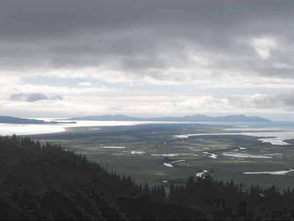
Photograph of Wingham Island taken from Suckling Hills looking west-southwest. (Photograph by James B. Chapman.)
Abstract
Marine terraces cut into Pleistocene deposits on Wingham Island in the Gulf of Alaska provide new constraints on the position of sea level, ice thickness and total glacioisostatic rebound at the end of the Last Glacial Maximum. A radiocarbon age of 13.9 ± 0.15 ka on the most prominent terrace is coincident with the end of meltwater pulse 1A, possibly suggestive of a link between changes in relative sea level and terrace formation. Isostatic modeling suggests a local ice thickness of 600 to 700 m with high (~10 cm/yr) initial rates of postglacial rebound. In addition to the unique ties to meltwater pulse 1A, the timing of emergence for Wingham Island following the Last Glacial Maximum has implications for the early migration of humans into North America.
Download this paper as a 22-page PDF file (pp1760b.pdf; 1.6 MB)
For questions about the content of this report, contact Jay Chapman or Peter Haeussler
Suggested citation and version history
Back to Studies by the U.S. Geological Survey in Alaska, 2007
Download a free copy of the current version of Adobe Reader.
| Help
| PDF help
| Western reports main page | Western Professional Papers |
| Geologic
Division | Alaska Science Center
|
Alaska Mineral Resources
|
This report is available only on the Web

![]() U.S. Department of the Interior | U.S. Geological Survey
U.S. Department of the Interior | U.S. Geological Survey
URL: https://pubs.usgs.gov/pp/1760/b/
Page Contact Information: Michael Diggles
Page Created: April 17, 2009
Page Last Modified: June 2, 2009
(mfd)