U.S. Geological Survey Professional Paper 1788
List of Yellowstone Benchmarks
Back to Yellowstone National Park Benchmark Database
Back to USGS Professional Paper 1788
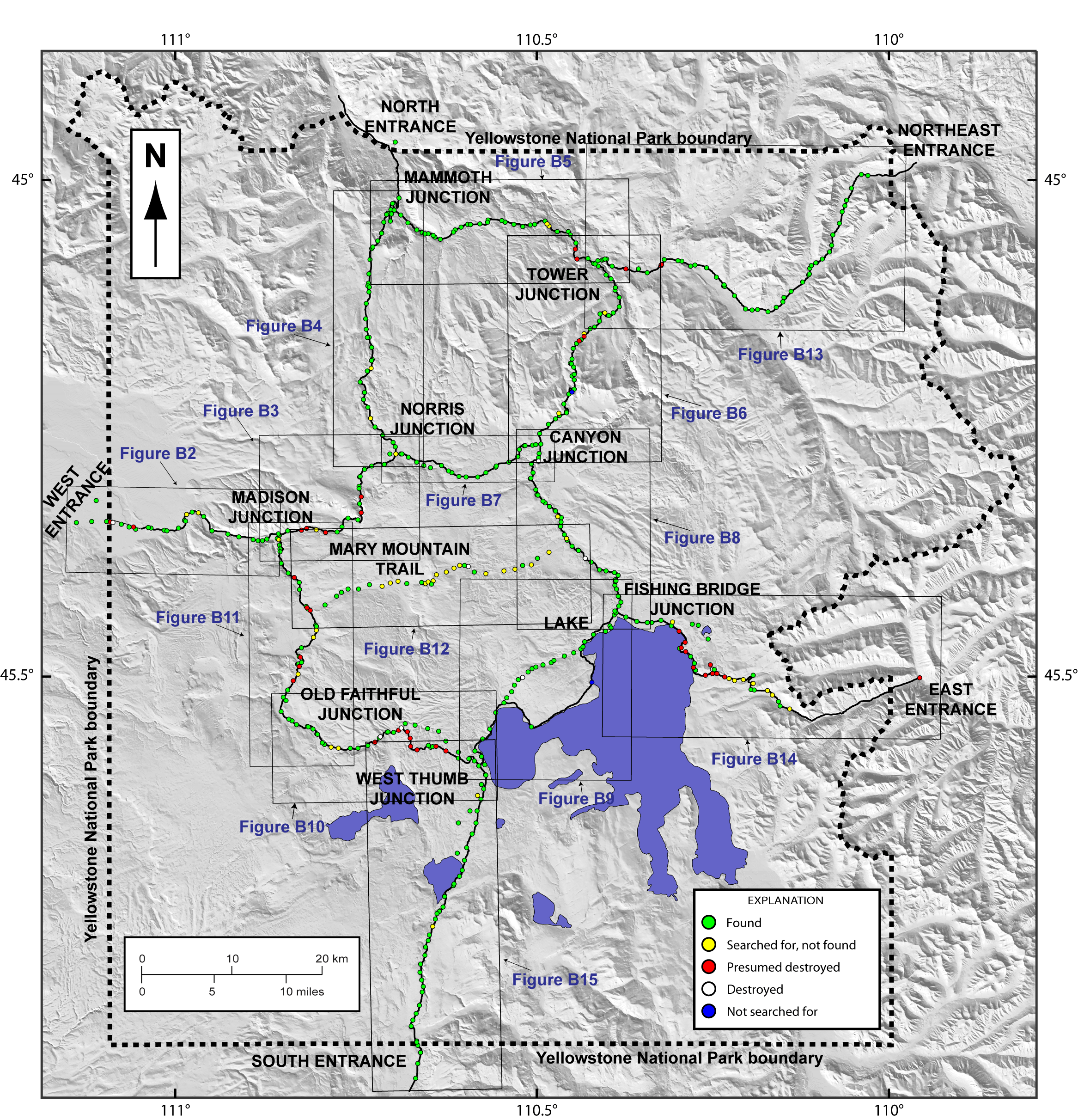
The following overview map is intended to orient the user to the geography of Yellowstone National Park. Scroll down or click here for the full-size interactive map.
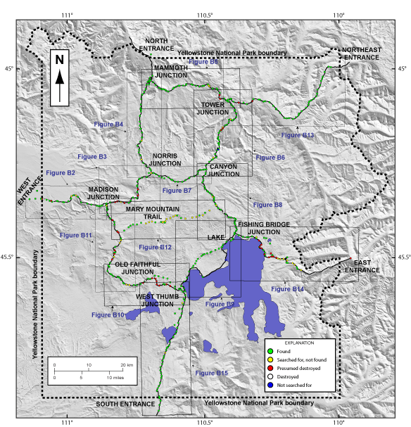
The boxes, labeled with the corresponding figure titles from the text of Professional Paper 1788, illustrate sub-maps for each leveling line. Click on the box to go to the zoomed-in sub-map. From there you will be able to click on individual benchmarks.
List of Yellowstone Benchmarks
Back to Yellowstone National Park Benchmark Database
Back to USGS Professional Paper 1788
Web-site design and database compilation by Megan McLay, USGS, CVO, Vancouver Wash. Address all inquiries to Dan Dzurisin (dzurisin@usgs.gov).

![]() U.S. Department of the Interior |
U.S. Geological Survey
U.S. Department of the Interior |
U.S. Geological Survey
URL: http://pubsdata.usgs.gov/pubs/pp/1788/pp1788_benchmarks/base-map.html
Page Contact Information: GS Pubs Web Contact
Page Last Modified: Thursday, 01-Dec-2016 16:23:21 EST

