FISC - St. Petersburg
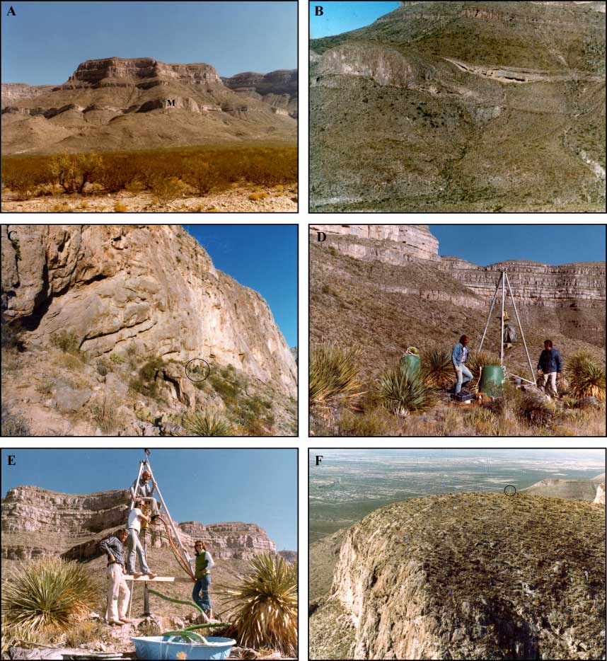
Figure 144. Aerial photos show (A) setting of Muleshoe Mound (M in center) in the Sacramento Mountains southeast of Albuquerque, New Mexico, (B) flanking beds in gorge on south side of mound in front of linear rock exposure, and (C) westward-facing mound escarpment. Escarpment is slightly more than 100 m (328 ft) high. Note drillers at base (circled). (D) Drill site on crest of Muleshoe. Food was wrapped in a plastic bag and hoisted to the top of the 4-m-tall (13-ft) tripod at the end of the day to protect against wildlife marauders. (E) Drill rig and drillers atop Muleshoe with “kiddie pool” mud pit in foreground. The Gobbler Formation in background is of Pennsylvanian age (~300 Ma; Fig. 7B). (F) Aerial view of Muleshoe and drill site (tripod circled).
|
Can't see the printable PDF version? Get the free Adobe Acrobat® Reader. |

![]() U.S. Department of the Interior |
U.S. Geological Survey
U.S. Department of the Interior |
U.S. Geological Survey
URL: [disc] /pubs/pp/2007/1751/professional-paper/summary/figures/fig144.html
Page Contact Information: Feedback
Page Last Modified: December 01, 2016 @ 04:12 PM (JSS)
