FISC - St. Petersburg
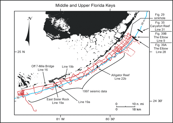
Figure 27. Index map shows USGS seismic tracklines (red) in the upper and middle Florida Keys and those portions of profile data selected (bold black) from the Tile 1 sector for illustration with their figure numbers (modified from Lidz et al., 2003; Figs. 29, 35, 39A, 39B). Shelf-margin contour (blue) is in meters.
|
Can't see the printable PDF version? Get the free Adobe Acrobat® Reader. |

![]() U.S. Department of the Interior |
U.S. Geological Survey
U.S. Department of the Interior |
U.S. Geological Survey
URL: [disc] /pubs/pp/2007/1751/professional-paper/tile1/figures/fig27.html
Page Contact Information: Feedback
Page Last Modified: December 01, 2016 @ 04:12 PM (JSS)
