FISC - St. Petersburg
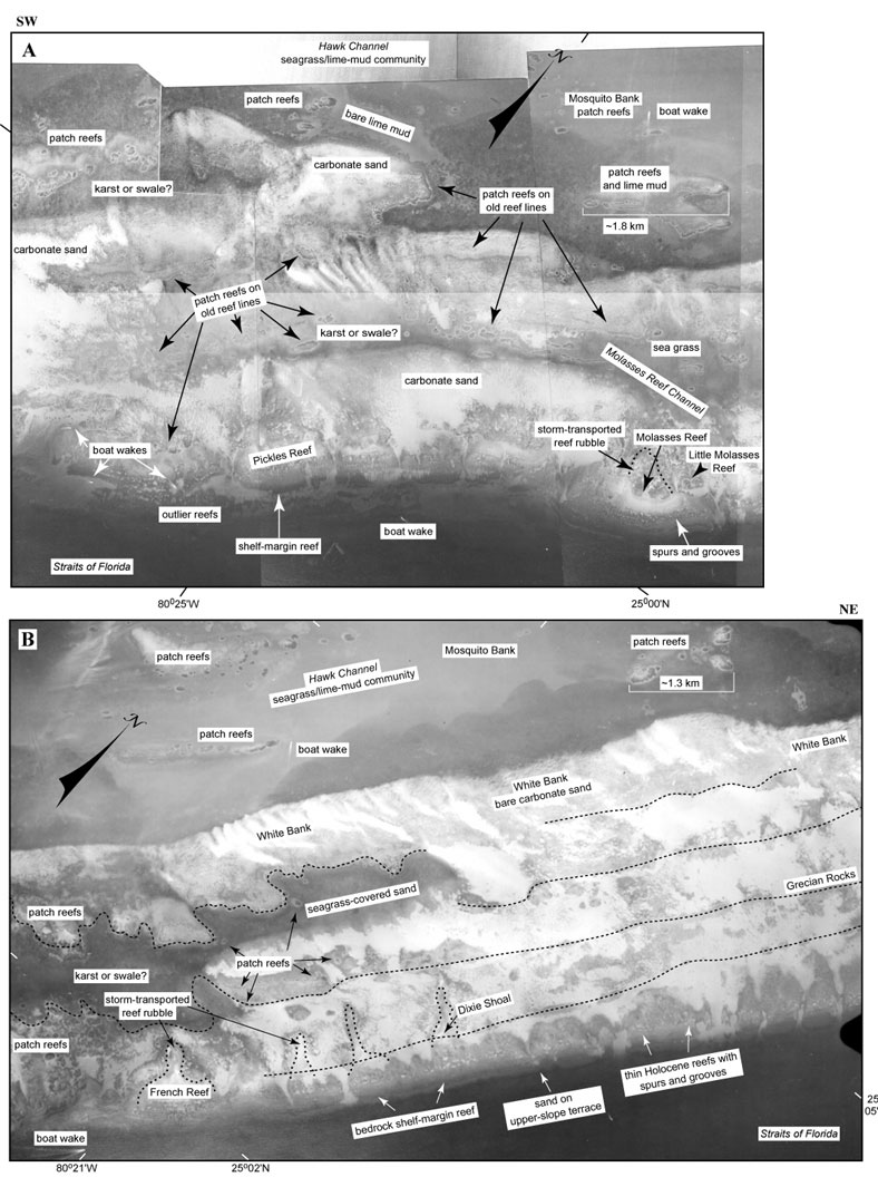
Figure 33A-B. Contiguous photomosaics (1975) show features and benthic environments on the outer shelf and margin seaward of Key Largo (compare with interpretive Benthic Ecosystems for Tile 1). Photomosaic covers nearly all of the seaward part of Tile 1 (Fig. 22B). Proceeding southwestward (right to left), (B) shows the backreef marine sand belt of White Bank, located seaward of the Mosquito Bank reentrant in the Hawk Channel bedrock depression (modified from Lidz et al., 2003). Note rock ridges (dotted lines) and sinuosity of ridges around possible karst or swale feature. (A) Continuing rock ridges or old reef lines capped by hundreds of patch reefs are clearly visible and thus are not marked by dotted lines. Because the shelf is generally less than 12 m deep (Enos, 1977), high-quality aerial photographs are extremely useful for interpreting seabed characteristics. Photos used in this project revealed important geologic features that were either (a) below seismic resolution (<1 m high, e.g., the series of outer-shelf rock ridges, Fig. 87, Tile 6) or (b) missed by seismic tracklines (e.g., a fourth tract of outlier reefs off Sand Key Reef in the lower Keys, Fig. 106, Tile 7/8; Lidz et al., 2003).
|
Can't see the printable PDF version? Get the free Adobe Acrobat® Reader. |

![]() U.S. Department of the Interior |
U.S. Geological Survey
U.S. Department of the Interior |
U.S. Geological Survey
URL: [disc] /pubs/pp/2007/1751/professional-paper/tile1/figures/fig33.html
Page Contact Information: Feedback
Page Last Modified: December 01, 2016 @ 04:12 PM (JSS)
