FISC - St. Petersburg
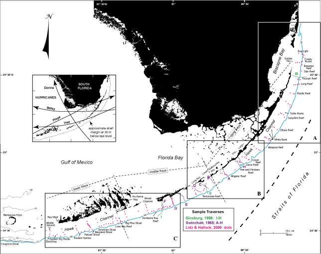
Figure 59. Index map of south Florida shows location of major geographic features, major coral reefs along the shelf margin (blue depth contour, in meters), and colored transects of three studies (in small box) that examined skeletal grains in surface sediments (from Lidz and Hallock, 2000). Dashed lines delineate the upper, middle, and lower Keys. Note locations and widths of tidal passes in the middle Keys compared to those in the upper and lower Keys. Inset under North arrow shows paths of major hurricanes in the area between sample years 1952 and 1989. Offshore arrows indicate northwestward Gulf Stream axis. Boxes A-C are enlarged in Figure 60A, 60B, and 60C. Area sampled in 1989 (red dots = sample sites of Lidz and Hallock, 2000) measures roughly 600 nmi2.
|
Can't see the printable PDF version? Get the free Adobe Acrobat® Reader. |

![]() U.S. Department of the Interior |
U.S. Geological Survey
U.S. Department of the Interior |
U.S. Geological Survey
URL: [disc] /pubs/pp/2007/1751/professional-paper/tile3/figures/fig59.html
Page Contact Information: Feedback
Page Last Modified: December 01, 2016 @ 04:13 PM (JSS)
