FISC - St. Petersburg
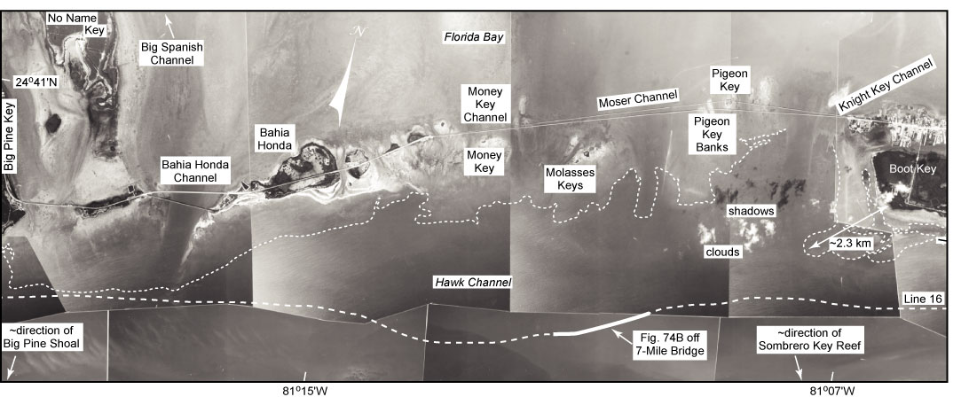
Figure 81. Aerial photo (1991) shows features in area of Moser and Bahia Honda Channels (lower middle Keys, Fig. 77C; from Lidz et al., 2003). Bahia Honda Channel is sufficiently deep to be part of the Intra-Coastal Waterway. White dotted line marks seaward edge of a nearshore rock ledge. Bold dashed line shows trackline of 1997 seismic Line 16 along the north edge of Hawk Channel (Fig. 74B).
|
Can't see the printable PDF version? Get the free Adobe Acrobat® Reader. |

![]() U.S. Department of the Interior |
U.S. Geological Survey
U.S. Department of the Interior |
U.S. Geological Survey
URL: [disc] /pubs/pp/2007/1751/professional-paper/tile5/figures/fig81.html
Page Contact Information: Feedback
Page Last Modified: December 01, 2016 @ 04:14 PM (JSS)
