FISC - St. Petersburg
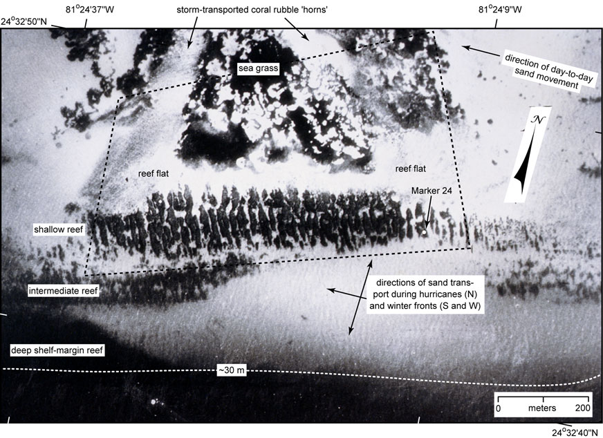
Figure 88. Closeup aerial view of Looe Key Reef 'core' area (black dotted lines) shows its various reef zones in 1975. Each zone consists of spurs and grooves that are being buried by sand. The intermediate reef is actually two reef trends, easily discernible in distal photos (Fig. 87A). The deep reef is a section of the shelf-margin reef at the south edge of the Looe Key Sanctuary. The deep reef is continuous in this area, extending east and west several hundred meters within the Sanctuary, and is being buried by a prominent sand lobe (Lidz et al., 1985). Sand coverage extends seaward and westward, indicating southward and westward directions of transport. The rubble 'horns' landward of the reef zones consist of storm-transported pebble- to boulder-size coral debris (4 to 256 mm). Area of reef flat at right near U.S. Coast Guard Marker 24 is awash at low tide.
|
Can't see the printable PDF version? Get the free Adobe Acrobat® Reader. |

![]() U.S. Department of the Interior |
U.S. Geological Survey
U.S. Department of the Interior |
U.S. Geological Survey
URL: [disc] /pubs/pp/2007/1751/professional-paper/tile6/figures/fig88.html
Page Contact Information: Feedback
Page Last Modified: December 01, 2016 @ 04:14 PM (JSS)
