FISC - St. Petersburg
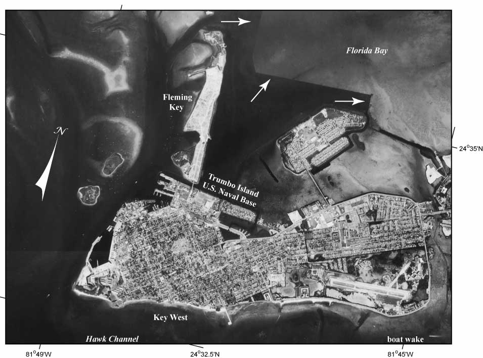
Figure 105. Key West (Fig. 97C) is one of the highest-elevation islands (~5.5 m above sea level) in the keys (Lidz and Shinn, 1991) and hence is densely urbanized. The skewed roughly rectangular area (134 acres) of Trumbo Island was constructed to house the Overseas Railroad terminal (Parks, 1968). Note three wharves at left end where train-carrying ferries docked. The ferries operated between Key West and Cuba. Also note dark area of deep water with sharp corners in Florida Bay (arrows) where marl and rock were cut and dredged by the U.S. Navy to build Fleming Key, part of the Key West Naval Base. Photo taken in 1991 by the National Ocean Service (NOAA, National Geodetic Survey).
|
Can't see the printable PDF version? Get the free Adobe Acrobat® Reader. |

![]() U.S. Department of the Interior |
U.S. Geological Survey
U.S. Department of the Interior |
U.S. Geological Survey
URL: [disc] /pubs/pp/2007/1751/professional-paper/tile7-8/figures/fig105.html
Page Contact Information: Feedback
Page Last Modified: December 01, 2016 @ 04:14 PM (JSS)
