![]()
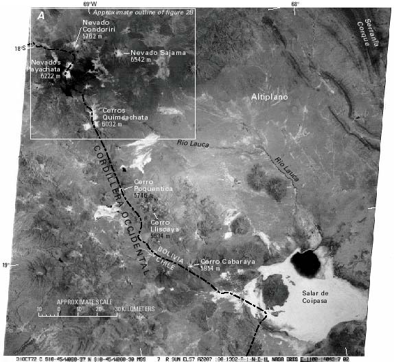
Figure 2.--Cordillera Occidental of Bolivia and Chile.
A, Annotated Landsat 1 MSS image showing area from Nevado Condoriri to Salar de Coipasa. The scene includes the glacierized areas of Nevados Payachata and Sajama, as well as Cerros Quimsachata and several volcanoes on the Bolivian Altiplano. Landsat 1 MSS image (1100-14043; band 7; 31 October 1972; Path 251, Row 73) from the EROS Data Center, Sioux Falls, S. Dak.
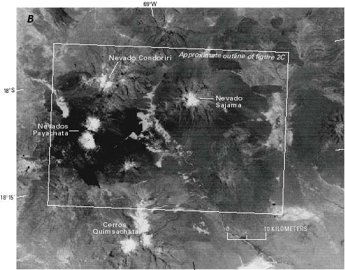
B, Annotated 1:500,000-scale enlargement of part of the Landsat 1 MSS satellite image shown in A. The snow-and-ice cover of the three glacier complexes in the central Cordillera Occidental is evident. These glaciers are the southernmost in Bolivia; no volcanoes located south of the Quimsachata group have an ice cap. At the time the image was acquired on 31 October 1972, the transient snowline elevation was average.
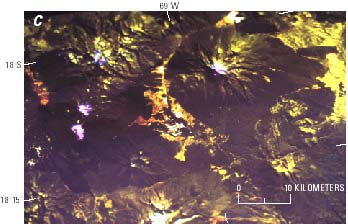
C, Landsat 5 TM false-color composite image of the Nevados Payachata and Sajama area acquired on 17 July 1993. The color composite was created by using bands 3, 5, and 4, and snow-and-ice areas appear pink. Comparison of B and C shows a much smaller amount of snow-and-ice cover on the later image, although shadows conceal part of the glacierized areas on the southwestern slopes of the volcanoes in C.
| Click the "Close" box to exit this window. |
U.S. Geological Survey, U.S.Department of the Interior