![]()
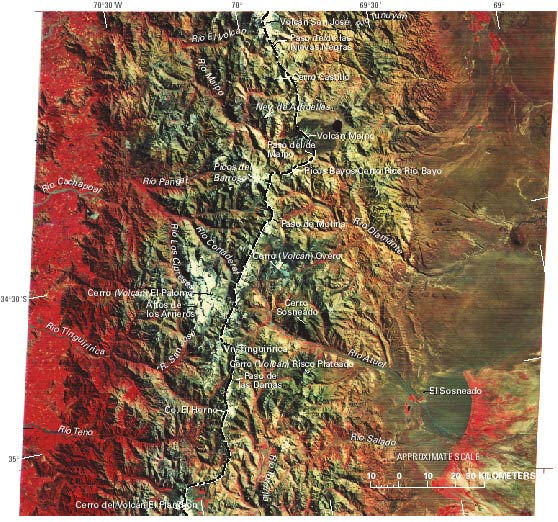
Figure 10.--Annotated Landsat MSS false-color composite image (2418-13420, bands 4, 5, and 7; 15 March 1976; Path 249, Row 84) of the Central Andes. The area covered is just to the south of figure 9. Abbreviations: Co., Cerro, mountain; Nev., Nevado, snow and (or) ice-capped mountain; R., Río; Vn., Volcán. Landsat image is from the EROS Data Center, Sioux Falls, S. Dak.
| Click the "Close" box to exit this window. |
U.S. Geological Survey, U.S.Department of the Interior