![]()
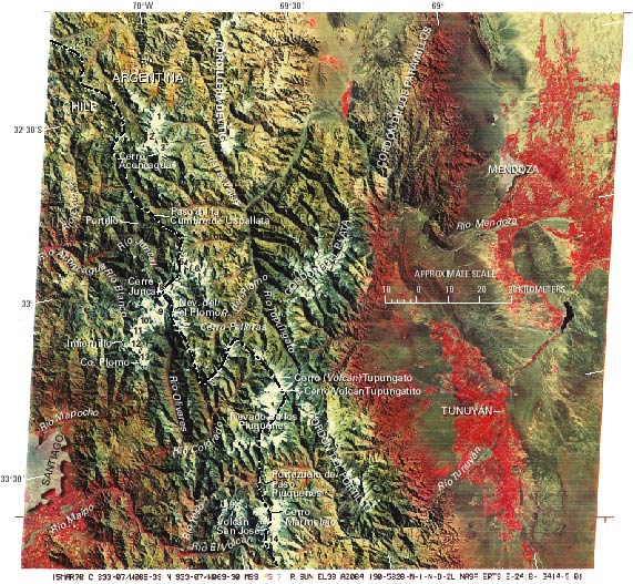
Figure 9.--Annotated Landsat MSS false-color composite image (2418-13414, bands 4, 5, and 7; 15 March 1976; Path 249, Row 83) of the Central Andes between Santiago and Mendoza from Cerro Aconcagua to Volcán San José. Landsat image is from the EROS Data Center, Sioux Falls, S. Dak.The following glaciers are indicated by numbers:
| 1, Glaciar de las Vacas | 8, Glaciar Juncal Norte |
| 2, Glaciar Güssfeldt | 9, Glaciar Juncal Sud |
| 3, Glaciar de los Polacos | 10, Glaciar Olivares Gamma |
| 4, Glaciar Horcones Inferior | 11, Glaciar Olivares Beta |
| 5, Glaciar Alto del Río Plomo | 12, Glaciar Olivares Alfa |
| 6, Glaciar Bajo del Río Plomo | 13, Glaciar Esmeralda |
| 7, Glaciar Juncal E-2 | 14, Glaciar Nieves Negras Chileno |
| Click the "Close" box to exit this window. |
U.S. Geological Survey, U.S.Department of the Interior