![]()
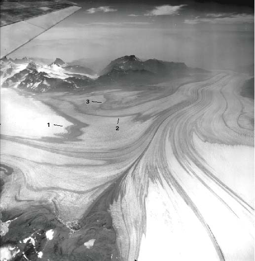
Figure 46.--Trimetrogon (oblique) aerial photograph 410-R-206 taken on 23 January 1945 showing three transverse bands of tephra on Glaciar Viedma. Although the photograph was taken at the same time as that of figure 45, the uppermost tephra layer (1) is located at the firn limit. Glaciers in the left background are in the drainage basin of Río Túnel. The pass through which F. Reichert gained access to the ice field in 1916, called Paso del Viento, is clearly visible. In the foreground is Nunatak del Viedma, which I originally mistook for a crater.
| Click the "Close" box to exit this window. |
U.S. Geological Survey, U.S.Department of the Interior