![]()
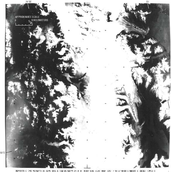
Figure 50.--Landsat 3 RBV image (30368-13453-B; Path 248, Row 94) of the central part of the Southern Patagonian Ice Field taken on 8 March 1979. Tephra from Cerro (Volcán) Lautaro can be seen on the west side of the ice field in the vicinity of Fiordo Falcón and Fiordo Penguín, 110 km south of the volcano. On the east side, medial moraines and looped bands of tephra on Glaciar Viedma and Glaciar Upsala are visible. Landsat image is from the EROS Data Center, Sioux Falls, S. Dak.
| Click the "Close" box to exit this window. |
U.S. Geological Survey, U.S.Department of the Interior