![]()
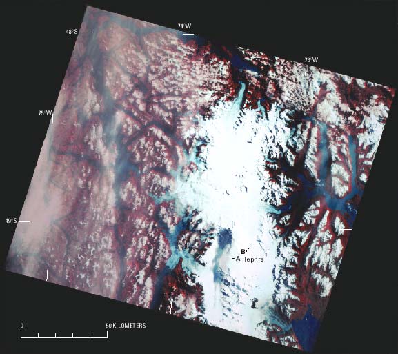
Figure 51.--Landsat MSS false-color composite image of the Southern Patagonian Ice Field (see fig. 29). In this image, tephra is visible more than 50 km to the south (A) and also as an isolated spot on Corredor Hicken (B), 15 km to the east-southeast of Cerro (Volcán) Lautaro. A thin fog covers the ice field. Landsat image (30368-13450, band 5; 8 March 1979; Path 248, Row 94) is from the EROS Data Center, Sioux Falls, S. Dak.
| Click the "Close" box to exit this window. |
U.S. Geological Survey, U.S.Department of the Interior