Climate-Vegetation Atlas of North America
This page should be in a new browser window. Move it aside to view the introduction text.
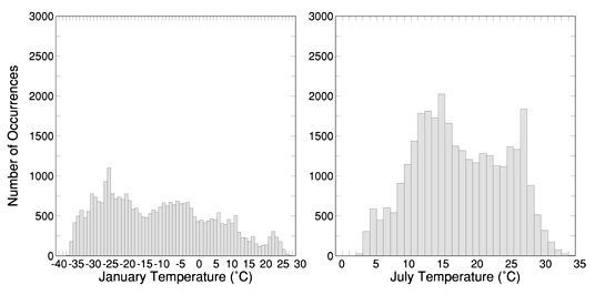
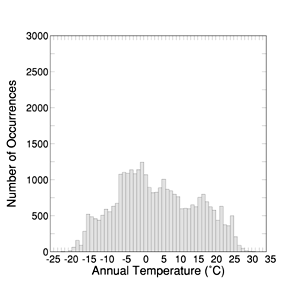
Figure 5. Histograms illustrating the distributions of mean January, July, and annual temperatures among points of the 25-km grid for North America. The height of each column represents the number of grid points that occur within the specified range of temperature on the horizontal axis.
| AccessibilityFOIAPrivacyPolicies and Notices | |
| |
|