Climate-Vegetation Atlas of North America
This page should be in a new browser window. Move it aside to view the introduction text.
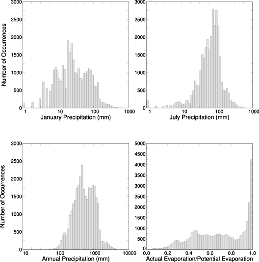 Figure 14. Histograms illustrating distributions of mean January, July, and annual precipitation, and moisture index (MI--moisture index equals actual evaporation divided by potential evaporation) among points of the 25-km grid for North America. The height of each column represents the number of grid points that occur within the specified range of the climatic or bioclimatic variable on the horizontal axis. |
| AccessibilityFOIAPrivacyPolicies and Notices | |
| |
|