Küchler Potential Natural Vegetation — Index Maps
(Click on an index map to view the graphical display for that ecoregion.)
WESTERN FORESTS
Needleleaf Forests
Spruce-cedar-hemlock forest (Picea-Thuja-Tsuga)
Cedar-hemlock-Douglas fir forest (Thuja-Tsuga-Pseudotsuga)

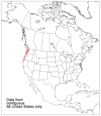
Silver fir-Douglas fir forest (Abies-Pseudotsuga)

Fir-hemlock forest (Abies-Tsuga)
Mixed conifer forest (Abies-Pinus-Pseudotsuga)
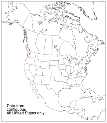
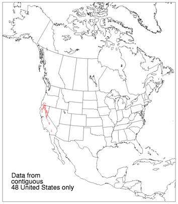
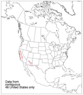
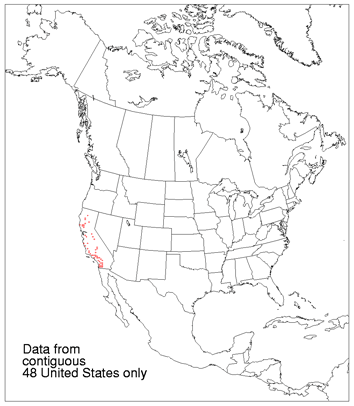
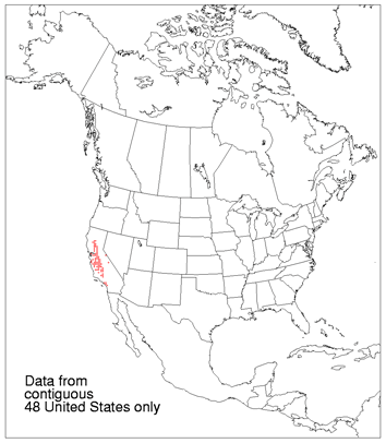
Redwood forest (Sequoia-Pseudotsuga)

Red fir forest (Abies)

Lodgepole pine-subalpine forest (Pinus-Tsuga)

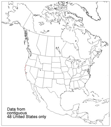
Pine-cypress forest (Pinus-Cupressus)

Ponderosa shrub forest (Pinus)
Western ponderosa forest (Pinus)
Douglas fir forest (Pseudotsuga)

Cedar-hemlock-pine forest (Thuja-Tsuga-Pinus)

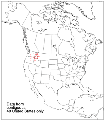
Grand fir-Douglas fir forest (Abies-Pseudotsuga)

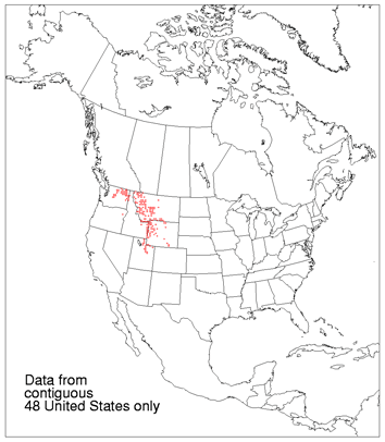
Western spruce-fir forest (Picea-Abies)
Eastern ponderosa forest (Pinus)

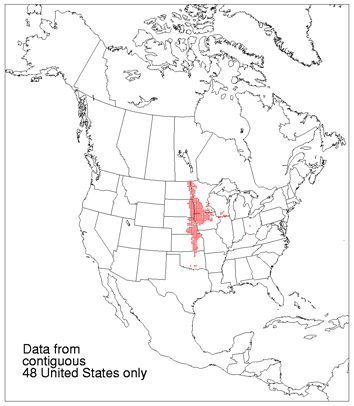
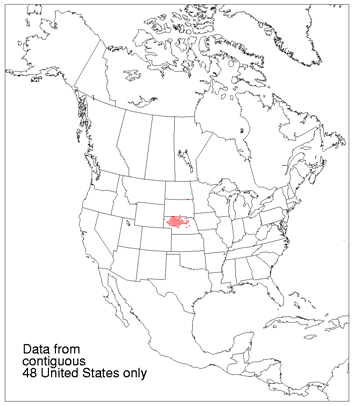
Black Hills pine forest (Pinus)
Pine-Douglas fir forest (Pinus-Pseudotsuga)

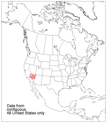
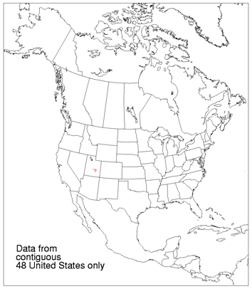
Arizona pine forest (Pinus)

Spruce-fir-Douglas fir forest (Picea-Abies-Pseudotsuga)

Southwestern spruce-fir forest (Picea-Abies)

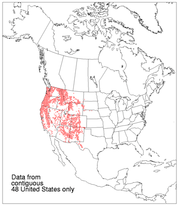
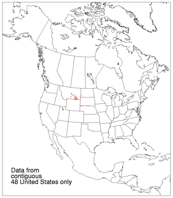
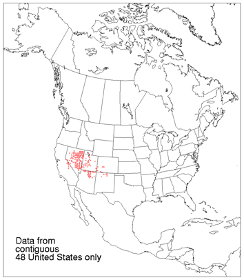
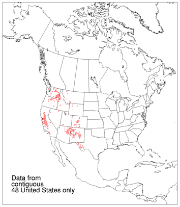
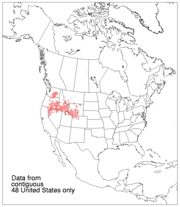
Great Basin pine forest (Pinus)
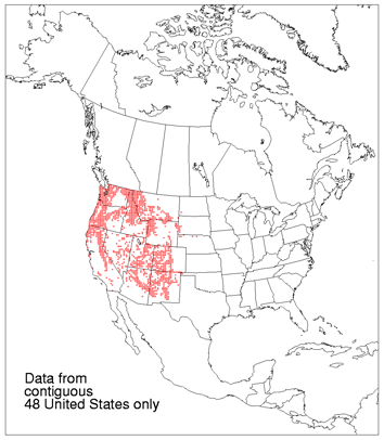
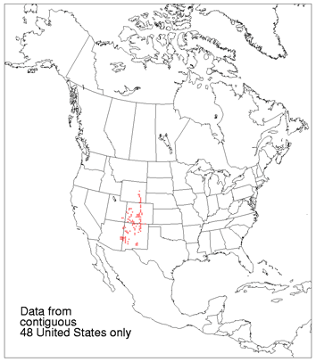
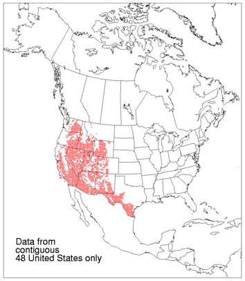
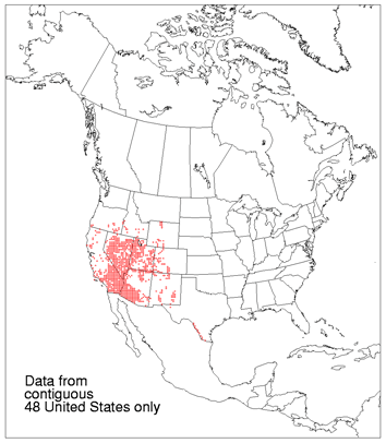
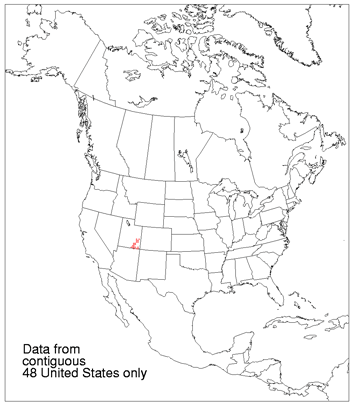
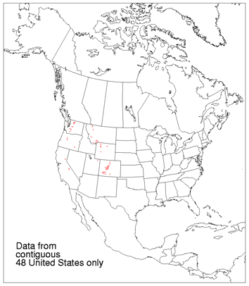
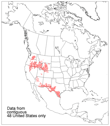
Juniper-pinyon woodland (Juniperus-Pinus)

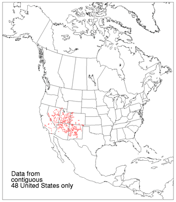
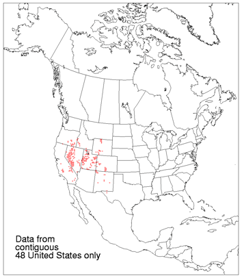
Juniper steppe woodland (Juniperus-Artemisia-Agropyron)

Broadleaf Forests

Alder-ash forest (Alnus-Fraxinus)
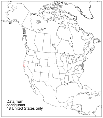
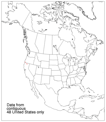
Oregon oakwoods (Quercus)
Broadleaf and Needleleaf Forests

Mosaic of cedar-hemlock-Douglas fir forest and Oregon oakwoods
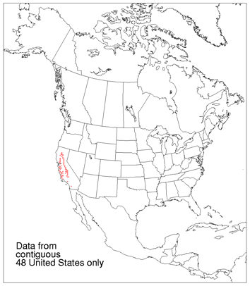
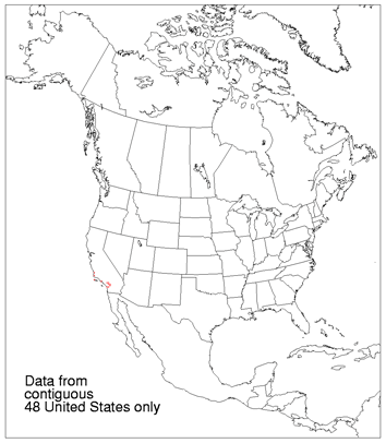
California mixed evergreen forest (Quercus-Arbutus-Pseudotsuga)
California oakwoods (Quercus)

Oak-juniper woodland (Quercus-Juniperus)

Transition between oak-juniper woodland and mountain mahogany-oak scrub
WESTERN SHRUB AND GRASSLAND
Shrub
Chaparral (Adenostoma-Arctostaphylos-Ceanothus)
Montane chaparral (Arctostaphylos-Castanopsis-Ceanothus)
Coastal sagebrush (Salvia-Eriogonum)

Mosaic of California oakwoods and coastal sagebrush

Mountain mahogany-oak scrub (Cercocarpus-Quercus)
Great Basin sagebrush (Artemisia)
Blackbrush (Coleogyne)
Saltbush-greasewood (Atriplex-Sarcobatus)
Creosote bush (Larrea)

Creosote bush-bur sage (Larrea-Franseria)

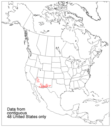
Palo verde-cactus shrub (Cercidium-Opuntia)

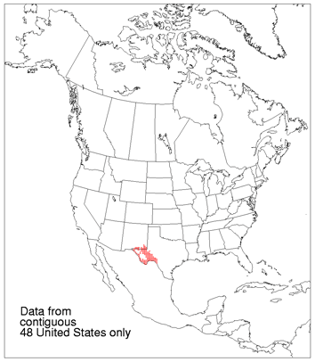
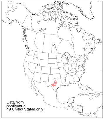
Creosote bush-tarbush (Larrea-Flourensia)
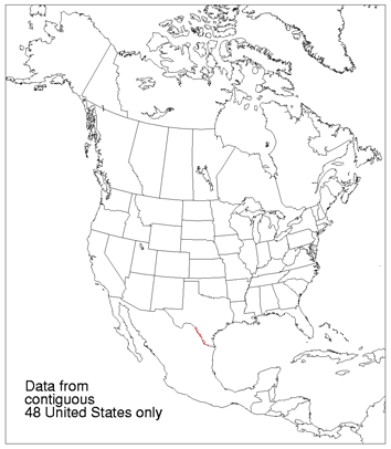
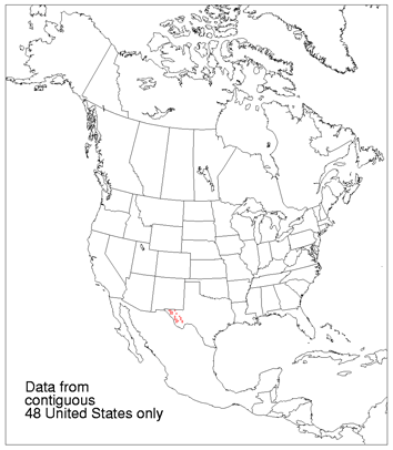
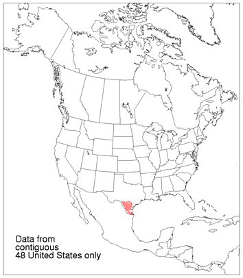
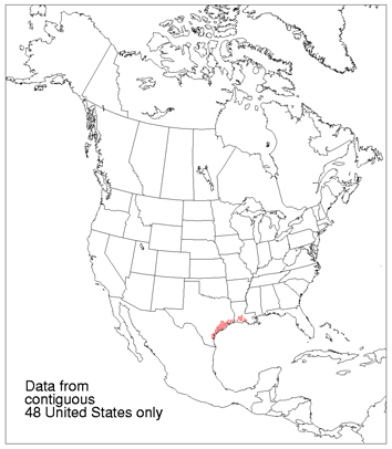
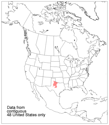
Ceniza shrub (Leucophyllum-Larrea-Prosopis)

Desert: vegetation largely absent
Grasslands

Fescue-oatgrass (Festuca-Danthonia)
California steppe (Stipa)

Tule marshes (Scirpus-Typha)

Fescue-wheatgrass (Festuca-Agropyron)

Wheatgrass-bluegrass (Agropyron-Poa)
Alpine meadows and barren (Agrostis, Carex, Festuca, Poa)

Fescue-mountain muhly prairie (Festuca-Muhlenbergia)

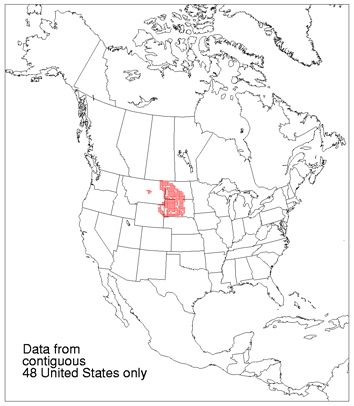
Grama-galleta steppe (Bouteloua-Hilaria)
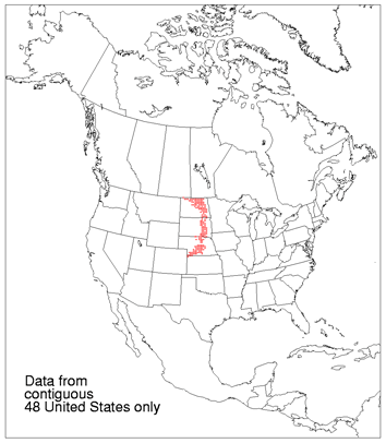
Grama-tobosa prairie (Bouteloua-Hilaria)
Shrub and Grasslands Combinations
Sagebrush steppe (Artemisia-Agropyron)

Wheatgrass-needlegrass shrubsteppe (Agropyron-Stipa-Artemisia)
Galleta-three awn shrubsteppe (Hilaria-Aristida)
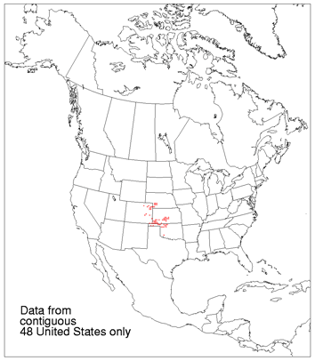
Grama-tobosa shrubsteppe (Bouteloua-Hilaria-Larrea)
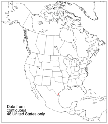
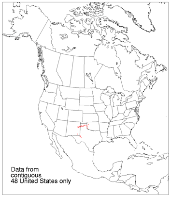
Trans-Pecos shrub savanna (Flourensia-Larrea)

Mesquite savanna (Prosopis-Hilaria)
Mesquite-acacia savanna (Prosopis-Acacia-Andropogon-Setaria)
Mesquite-live oak savanna (Prosopis-Quercus-Andropogon)
CENTRAL AND EASTERN GRASSLANDS
Grasslands

Foothills prairie (Agropyron-Festuca-Stipa)
Grama-needlegrass-wheatgrass (Bouteloua-Stipa-Agropyron)
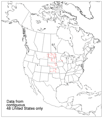
Grama-buffalo grass (Bouteloua-Buchloe)
Wheatgrass-needlegrass (Agropyron-Stipa)
Wheatgrass-bluestem-needlegrass (Agropyron-Andropogon-Stipa)

Wheatgrass-grama-buffalo grass (Agropyron-Bouteloua-Buchloe)

Bluestem-grama prairie (Andropogon-Bouteloua)
Sandsage-bluestem prairie (Artemisia-Andropogon)
Shinnery (Quercus-Andropogon)

Northern cordgrass prairie (Distichlis-Spartina)
Bluestem prairie (Andropogon-Panicum-Sorghastrum)
Nebraska Sandhills prairie (Andropogon-Calamovilfa)

Blackland prairie (Andropogon-Stipa)
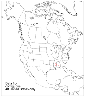
Bluestem-sacahuista prairie (Andropogon-Spartina)
Southern cordgrass prairie (Spartina)

Palmetto prairie (Serenoa-Aristida)
Grassland and Forest Combinations

Marl-Everglades (Mariscus and Persea-Taxodium)
Oak savanna (Quercus-Andropogon)
Mosaic of bluestem prairie and oak-hickory forest
Cedar glades (Juniperus-Quercus-Sporobolus)

Cross timbers (Quercus-Andropogon)
Mesquite-buffalo grass (Prosopis-Buchloe)
Juniper-oak savanna (Juniperus-Quercus-Andropogon)

Mesquite-oak savanna (Prosopis-Quercus-Andropogon)

Fayette prairie (Andropogon-Buchloe)
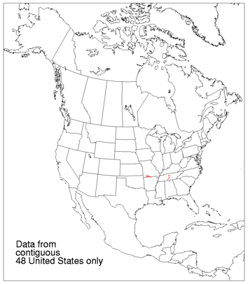
Blackbelt (Liquidambar-Quercus-Juniperus)
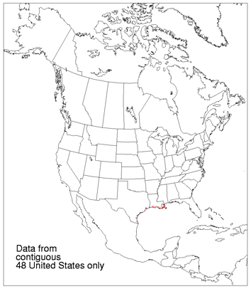
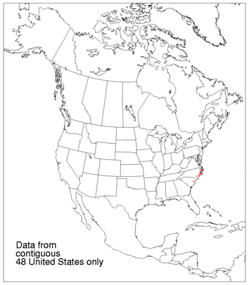
Live oak-sea oats (Quercus-Uniola)

Cypress savanna (Taxodium-Mariscus)
Everglades (Mariscus and Magnolia-Persea)
EASTERN FORESTS
Needleleaf Forests
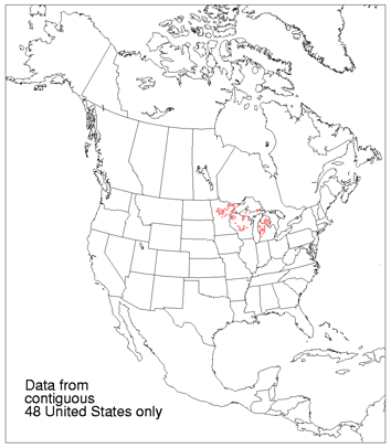
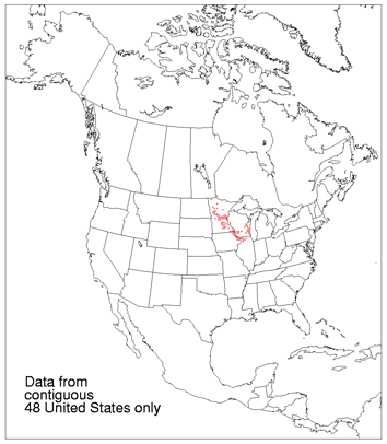
Great Lakes spruce-fir forest (Picea-Abies)

Conifer bog (Larix-Picea-Thuja)
Great Lakes pine forest (Pinus)
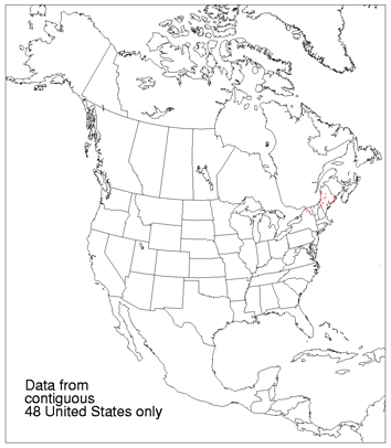
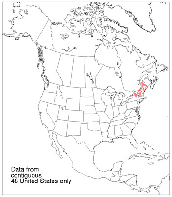
Northeastern spruce-fir forest (Picea-Abies)
Broadleaf Forests
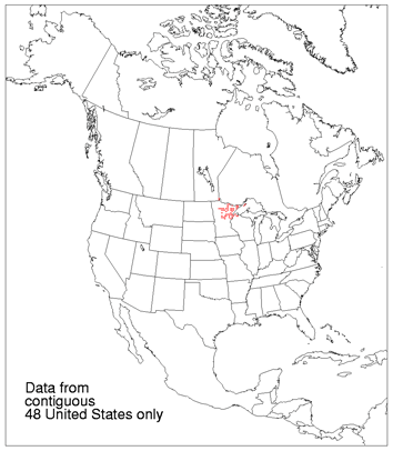
Northern floodplain forest (Populus-Salix-Ulmus)
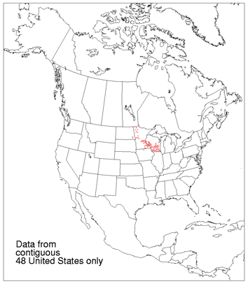
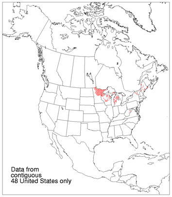
Maple-basswood forest (Acer-Tilia)
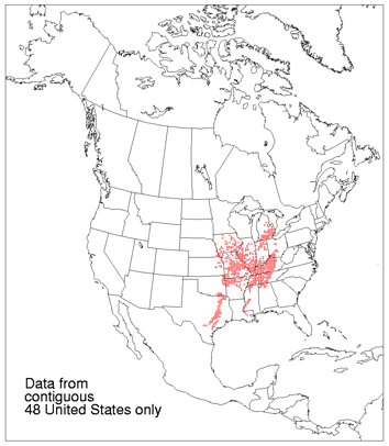
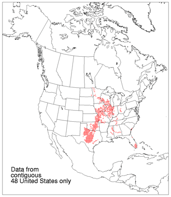
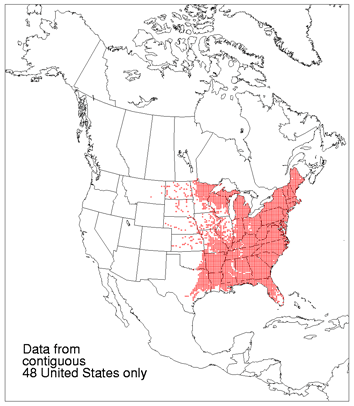
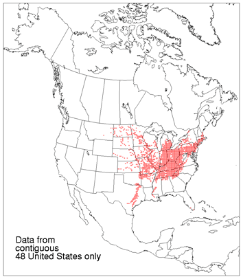
Oak-hickory forest (Quercus-Carya)
Elm-ash forest (Ulmus-Fraxinus)
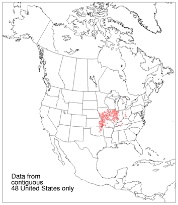
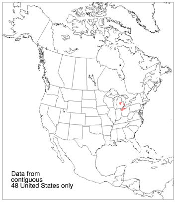
Beech-maple forest (Fagus-Acer)
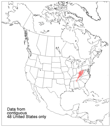
Mixed mesophytic forest (Acer-Aesculus-Fagus-Liriodendron-Quercus-Tilia)
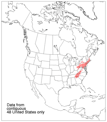
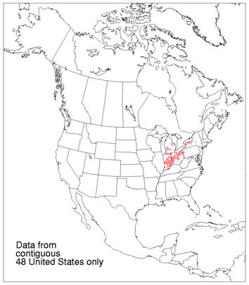
Appalachian oak forest (Quercus)

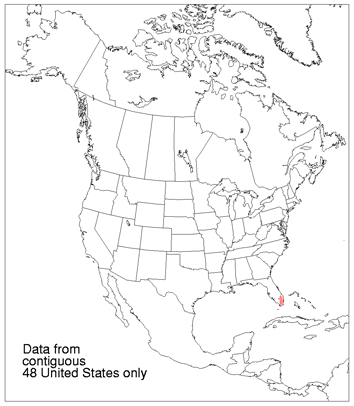
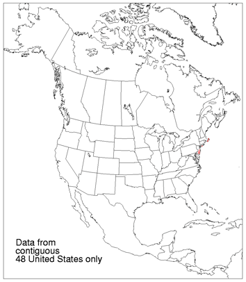
Mangrove (Avicennia-Rhizophora)
Broadleaf and Needleleaf Forests
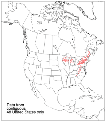
Northern hardwoods (Acer-Betula-Fagus-Tsuga)

Northern hardwoods-fir forest (Acer-Betula-Abies-Tsuga)
Northern hardwoods-spruce forest (Acer-Betula-Fagus-Picea-Tsuga)
Transition between Appalachian oak forest and northern hardwoods
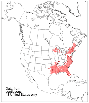
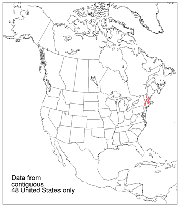
Northeastern oak-pine forest (Quercus-Pinus)
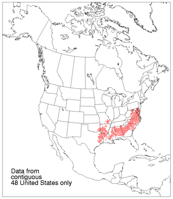
Oak-hickory-pine forest (Quercus-Carya-Pinus)
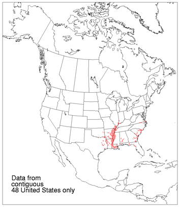
Southern mixed forest (Fagus-Liquidambar-Magnolia-Pinus-Quercus)
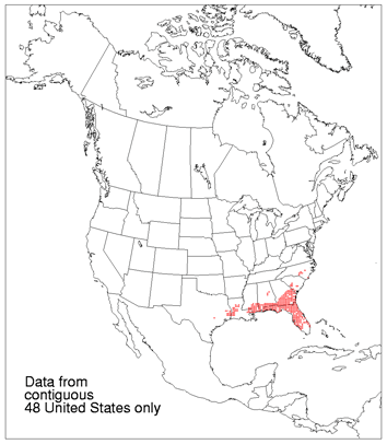
Southern floodplain forest (Quercus-Nyssa-Taxodium)
Pocosin (Pinus-Ilex)

Sand pine scrub (Pinus-Quercus)
Subtropical pine forest (Pinus-Tetrazygia)

