|
|
|
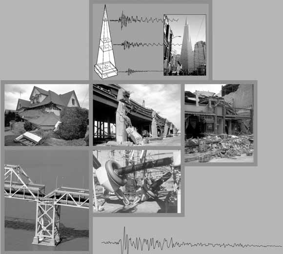
Although some scientists considered the Ms=7.1 Loma Prieta, Calif., earthquake of 1989 to be an anticipated event, some aspects of the earthquake were surprising. It occurred 17 km beneath the Santa Cruz Mountains along a left-stepping restraining bend in the San Andreas fault system. Rupture on the southwest-dipping fault plane consisted of subequal amounts of right-lateral and reverse motion but did not reach the surface. In the area of maximum uplift, severe shaking and numerous ground cracks occurred along Summit Road and Skyland Ridge, several kilometers south of the main trace of the San Andreas fault. The relatively deep focus of the earthquake, the distribution of ground failure, the absence of throughgoing surface rupture on the San Andreas fault, and the large component of uplift raised several questions about the relation of the 1989 Loma Prieta earthquake to the San Andreas fault: Did the earthquake actually occur on the San Andreas fault? Where exactly is the San Andreas fault in the heavily forested Santa Cruz Mountains, and how does the fault relate to ground ruptures that occurred there in 1989 and 1906? What is the geometry of the San Andreas fault system at depth, and how does it relate to the major crustal blocks identified by geologic mapping? Subsequent geophysical and geologic investigations of crustal structure in the Loma Prieta region have addressed these and other questions about the relation of the earthquake to geologic structures observed in the southern Santa Cruz Mountains. The diverse papers in this chapter cover several topics: geologic mapping of the region, potential- field and electromagnetic modeling of crustal structure, and the velocity structure of the crust and mantle in and below the source region for the earthquake. Although these papers were mostly completed between 1992 and 1997, they provide critical documentation of the crustal structure of the Loma Prieta region. Together, they present a remarkably coherent, three-dimensional picture of the earthquake source region—a geologically complex volume of crust with a long history of both right-lateral faulting and fault-normal compression, thrusting, and uplift. |
|
This publication consists of the following articles:
|
Download the text of this publication as a 209-page PDF file (pp1550e.pdf; 15.3 MB)
Download plate 1, Geologic map of the Loma Prieta region, California, by Robert J. McLaughlin, Joseph C. Clark, Earl E. Brabb, Edward J. Helley, and Carl M. Wentworth, as a ~49" x 41" PDF file (pp1550e_plate1.pdf; 19.6 MB)
Download plate 2 Stratigraphic columns across the San Andreas fault in the Loma Prieta region, California, comparing differences in thickness, lithology, and basement rock types in major fault blocks, by Robert J. McLaughlin, Joseph C. Clark, Earl E. Brabb, Edward J. Helley, and Carl M. Wentworth, as a ~17" x 16" PDF file (pp1550e_plate2.pdf; 2.3 MB)
Download plate 3 Maps showing residual-magnetic fields, isostatic-residual-gravity fields, and generalized geology of the southern San Francisco Bay and Loma Prieta regions, California, by Robert C. Jachens and Andrew Griscom, as a ~40" x 31" PDF file (pp1550e_plate3.pdf; 8 MB)
For questions about the content of this report, contact Ray Wells
|
This publication is part of the set of four multi-chapter USGS Professional Papers on the Loma Prieta, California, Earthquake of October 17, 1989: Professional Paper 1550, Earthquake Occurrence , Coordinators: William H. Bakun and William H. Prescott Professional Paper 1551, Strong Ground Motion and Ground Failure, Coordinator: Thomas L. Holzer Professional Paper 1552, Performance of the Built Environment, Coordinator, Thomas L. Holzer Professional Paper 1553, Societal Response, Coordinator: Dennis S. Mileti |
Download a copy of the latest version of Adobe Reader for free.
|
Help |
PDF help |
Publications main page |
This report is also available from:
USGS Information Services, Box 25286,
Federal Center, Denver, CO 80225
telephone: 888 ASK-USGS; e-mail: infoservices@usgs.gov
| Department of the Interior
| U.S. Geological Survey |
URL of this page: https://pubs.usgs.gov/pp/pp1550/pp1550e/
Maintained by: Michael Diggles
Created: September 20, 2004
Last modified: July 13, 2006 (mfd)