
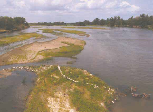
View from the bridge over the Platte River just south of Overton, Nebraska, looking downstream (to the east). (USGS photo taken in 2002 by Steven M. Condon.)
|
The Platte River of south-central Nebraska was studied at three scales to place the river in its geological context and to trace its evolution through geologic time. At the largest scale the Elm Creek West and the Newark 7.5 minute quadrangles were mapped. These quadrangles are located just west and just east of Kearney and serve to illustrate the main geomorphic elements of the present Platte River Valley. The central elements of the quadrangles are the Platte River channels, islands, and bottomlands, which are flanked by terraces that step up away from the river to the north and south. Significant other elements of the landscape are eolian sand and loess deposits. The geologic maps are supplemented by topographic profiles of the mapped terraces and graphical representations of subsurface units in test wells that occur within the quadrangles. An intermediate-scale study consisted of examining descriptions of well cuttings in a 17 county area in south-central Nebraska, which includes the Platte River Valley, and building a database of information about sediment lithology and thickness. The wells penetrated a sequence of gravel, sand, silt, and clay beds from the ground surface to the top of the subsurface Tertiary Ogallala Group or Cretaceous formations. The sequence consists of Pliocene-, Pleistocene-, and Holocene-age strata that document the deposition of a veneer of alluvium by late Tertiary and Quaternary streams intermixed with and overlain by wind-blown loess. Various isopleth and structure maps illustrate the distribution and alluvial architecture of the sedimentary sequence, and support the interpretation of former positions of the Platte River. A regional-scale study consisted of documenting the geologic history of the Front Range and adjacent mountains and depositional areas east of the mountains in Colorado, Wyoming, Kansas, and Nebraska from the end of the Cretaceous Period, about 65 million years ago, to the present. The structural and sedimentary history of the region is outlined, and a series of paleogeographic maps shows the development of the drainage system in the east-central Rocky Mountains and adjacent Plains. Ancestral South Platte, North Platte, and Laramie Rivers are recognized as early as the late Eocene, although the South Platte probably flowed to the southeast from the mountain front at that time. Deposits of the North Platte River are recognized on the west side of the Medicine Bow Mountains of Wyoming in the Miocene, and the presence of distinctive rock clasts indicates that the Laramie River flowed from the North Park area of Colorado northeast across a filled Laramie Basin and the Laramie Range of southeastern Wyoming in the Miocene. The present drainage system developed in the late Miocene to the Pliocene and included the capture and diversion of the South Platte River into its present channel. The combined North and South Platte Rivers deposited gravel and sand across Nebraska and flowed southeast from Kearney, Nebraska through the middle to late Pleistocene. Within the past 25,000 years the Platte River below Kearney was captured and diverted into its present course and confined there by bounding valley walls of loess. |
Download the text for Professional Paper 1706 as a 68-page PDF file (5.5 MB)
Download Plate 1: Geologic map and topographic profile of the Elm Creek West 7.5 minute quadrangle (38x36 inches; 7.4 MB)
Download Plate 2: Geologic map and topographic profile of the Newark 7.5 minute quadrangle (32x36 inches; 5.9 MB)
Download file list for the Elm Creek West compressed file (ElmCrkWestMap.txt; 56 KB)
Download compressed data for the Elm Creek West zip file (ElmCrkWestMap.zip; 1.8 MB)
Download file list for the Newark compressed file (NewarkMap.txt; 56 KB)
Download compressed data for the Newark zip file (NewarkMap.zip; 1.2 MB)
For questions about the content of this report, contact Steven Condon
Download a current version of Adobe Reader for free
| Help
| PDF help
| Western reports main page | Western Professional Papers |
| Privacy
Statement | Disclaimer
| Accessibility |
| Geologic
Division | Central Energy Team |
This report is also available from:
USGS Information Services, Box 25286,
Federal Center, Denver, CO 80225
telephone: 303-202-4210; e-mail: infoservices@usgs.gov