|
 |
of Eastern Colorado and Northeastern New Mexico
By Glenn R. Scott
|
|
Version 1.0
Published 2004
|
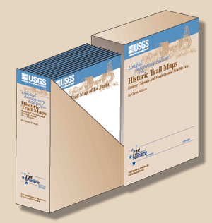
This limited-edition boxed set contains all 11 of Glenn Scott's
historic trail maps plus a richly illustrated pamphlet that provides
a biographical sketch of Scott, a description of how he started the
historic trail map series, and text sections that describe the Colorado
Gold Rush,
Santa Fe Trail, Mexican Land Grants, and other topics. We are pleased
to commemorate the USGS 125th Anniversary as well as celebrate our
rich Western heritage by presenting this special limited-edition set
of trail maps.
The boxed sets are available for purchase at Information
Services, U.S. Geological Survey (1-888-ASK-USGS).
|
Downloading Suggestion:
It is best to download a large PDF file to your hard drive rather than
open it inside your browser. (A standard click may automatically open
the PDF file inside the browser but doing so will result in a very slow
load.)
|
|
For guidance on how to do this, go to http://cpg.cr.usgs.gov/toolbox/download_advice.html.
Downloading the PDF file may take several moments but will be
worth the wait. Once it is downloaded, open the PDF from your hard
drive
using
Adobe Acrobat—it will load in a fraction of the time it
would take to open the PDF over the internet.
|
|
The text of this report is presented here in Portable Document Format.
The latest version of Adobe Acrobat Reader® or similar software is
required to view it. If you wish to download the latest version of Acrobat
Reader® free of charge, click here.
|
|
|
Individual trail maps
are also available for purchase at Information Services, U.S.
Geological Survey (1-888-ASK-USGS). The Denver, Trinidad, and
Leadville trail maps are also available online and the links
to the online versions are provided below.
|
|
|
|
|
| 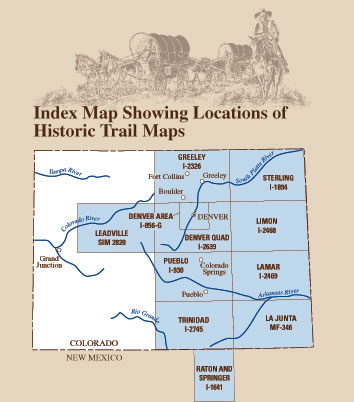 |
Historic Trail Map of the Greater Denver Area,
Colorado (1976)
|
Historic Trail Maps of the Pueblo 1° x 2° Quadrangle,
Colorado (1975)
|
Historic Trail Map of the La Junta 1° x 2° Quadrangle,
Colorado (1972)
|
|
| |
|
|