| Scientific Investigations Map 2835 |
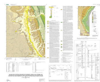
Geologic map of the Peach Orchard Flat quadrangle, Carbon County, Wyoming, and descriptions of new stratigraphic units in the Upper Cretaceous Lance Formation and Paleocene Fort Union Formation, eastern Greater Green River Basin, Wyoming-Colorado |
By J.G. Honey and R.D. Hettinger |
 |
| Version 1.1 |
Published 2004 In version 1.1 of this map, a correction is made regarding the location of the Overland Member of the Fort Union Formation at its type locality. The correct location of the top of the measured section is 600 ft from the west line and 1,150 ft from the south line of sec. 34, T. 17 N., R. 92 W., Doty Mountain 7.5-minute quadrangle. |
| The text of this report is presented here in Portable Document Format. The latest version of Adobe Acrobat Reader® or similar software is required to view it. If you wish to download the latest version of Acrobat Reader® free of charge, click here. |
| SIM 2835 PDF file (8.24 MB) | For printing and viewing |
| (This version of the report is accessible as defined in Section 508.) |
| Readme TXT file (3 KB) |
| SIM 2835 MET file (19 KB) | Metadata file |
| 2835.zip (545 KB) | ZIPPED archive of ArcInfo and ArcView files |
| 2835.tar.gz (546 KB) | TARRED and GZIPPED archive of ArcInfo and ArcView files |
| bases.zip (1.38 MB) | ZIPPED archive of base maps images |
| bases.tar.gz (1.37 MB) | TARRED and GZIPPED archive of base maps images |
| AccessibilityFOIAPrivacyPolicies and Notices | |
| |
|