
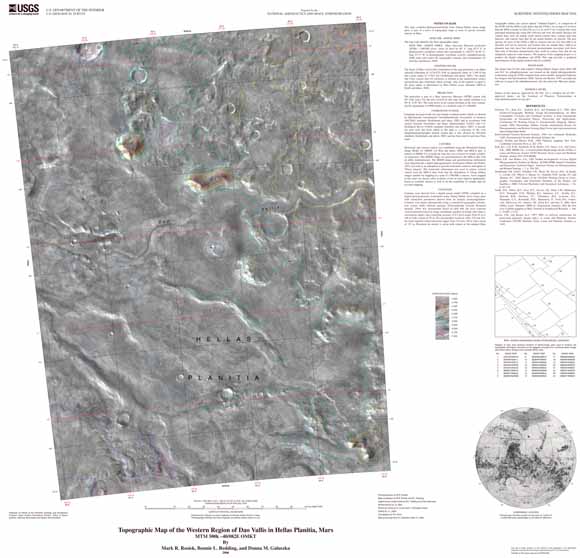
| This map, compiled photogrammetrically from Viking Orbiter stereo image pairs, is part of a series of topographic maps of areas of special scientific interest on Mars. Contours were derived from a digital terrain model (DTM) compiled on a digital photogrammetric workstation using Viking Orbiter stereo image pairs with orientation parameters derived from an analytic aerotriangulation. The image base for this map employs Viking Orbiter images from orbits 406 and 363. An orthophotomosaic was created on the digital photogrammetric workstation using the DTM compiled from stereo models. |
Download this map as a PDF document (~33 x 32 inches; 2.3 MB)
For questions about the content of this report, contact Mark Rosiek
Download a current version of Adobe Reader for free
| Help
| PDF help
| Publications main page | Other Planetary Maps |
| Privacy
Statement | Disclaimer
| Accessibility |
| Geologic Division |
Astrogeology Research Program |
This map is available only on the Web