Scientific Investigations Map 2960
By Richard J. Reynolds
U.S. Geological Survey Scientific Investigations Map 2960
 |
This Report is available Online Only Sheet 1 - Locations of wells and test holes (North) - PDF format (1,770 KB)
|
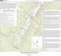
The nature and extent of valley-fill aquifers in the Port Jervis Trough was evaluated for a 16 mile section of this valley from the Orange-Sullivan County line near Westbrookville to the village of Napanoch in Ulster County as part of the U.S. Geological Survey’s Detailed Aquifer Mapping Program in New York State. The principal aquifer in the Port Jervis Trough is a 50 feet thick outwash aquifer that extends from the Phillipsport Moraine near Summitville, southward through the study area to Port Jervis, N.Y. Previous studies had estimated as much as 500 feet of saturated drift in parts of the Trough, but new well data show that much of the valley fill consists of fine-grained lacustrine sediments. Drillers’ logs show that the outwash aquifer south of Summitville is underlain by as much as 275 feet of lacustrine silt and clay. North of the Phillipsport Moraine, three large glaciolacustrine deltas that were built into Glacial Lake Wawarsing provide some local and discontinuous confined aquifers through their coarser bottomset beds. Elsewhere in the Trough, collapsed and buried portions of kame deltas and terraces provide local confined aquifers. The outwash aquifer appears to be very transmissive, as evidenced by the high specific capacity of 130 gallons per minute per foot [(gal/min)/ft] of a commercial test well screened in the aquifer.
Reynolds, R.J., 2007, Hydrogeologic appraisal of the valley-fill aquifer in the Port Jervis Trough, Sullivan and Ulster Counties, New York: U.S. Geological Survey Scientific Investigations Map 2960, 5 sheets, online only
If you have Adobe Acrobat® or Adobe Acrobat Reader® installed on your computer, you may view and print the PDF version of this report. Acrobat Reader, is a free download from Adobe Systems, Inc. Users with disabilities can view information concerning accessibility at access.Adobe.com .
For further information, contact:
Director
U.S. Geological Survey
New York Water Science Center
425 Jordan Road
Troy, NY 12180
(518)285-5600
or visit our Web site at: http://ny.water.usgs.gov

![]() U.S. Department of the Interior |
U.S. Geological Survey
U.S. Department of the Interior |
U.S. Geological Survey
URL: https://pubs.usgs.gov/sim/2007/2960/
Page Contact Information: USGS Publishing Network
Page Last Modified: Thursday, 01-Dec-2016 17:09:03 EST
