
|
|
Scientific Investigations Map 2940 |
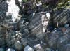
| Kt-3. Cretaceous tonalite dike of Clark Mountain stock (Kt) intruding Napeequa Schist (Kns). Rotated schist fragments show magmatic nature of the deep-seated synorogenic pluton. Outcrop at head of Boulder Creek near Boulder Pass [Tsw]. |

|
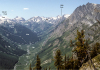
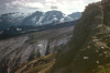
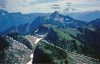
Other photos that show unit Kt:
      |
  |