
|
|
Scientific Investigations Map 2940 |
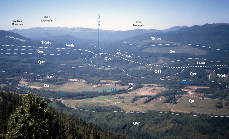
| Qvt-1. View north from Wheeler Mountain [SRsw] across North Fork Stillaguamish River valley. Vashon till (Qvt) mantles slopes above terraces of Vashon recessional outwash deposits (Qvr) and alluvium of valley bottoms (Qa) are prominent. Other rocks and deposits shown, much simplified: QTl, landslide; TKhm, Helena-Haystack mélange; TKeb, eastern mélange belt; Devils Mountain fault is south boundary of Darrington-Devils Mountain Fault Zone. View image without annotation |
|