Scientific Investigations Map 3002
Significant new mapping during the last two decades has added considerably to understanding the geologic history of the western Transverse and southern Coast Ranges (Vedder and others, 1994, 1995, 2001; Kellogg, 1999, 2003; Kellogg and Miggins, 2002; Minor, 1999, 2004; Stone and Cossette, 2000). Prior to this time, the late Thomas W. Dibblee, Jr. mapped much of the Cuyama 1:100,000 quadrangle. The recent mapping has allowed us to revise some of Dibblee’s interpretations, as well as those of Crowell and others (1964), and to meet the U.S. Geological Survey’s (USGS) publication standard by digitally capturing and converting new data within a Geographic Information System (GIS) designed and published by Environmental Systems Research Institute (ESRI). |
Version 1.0 Posted August 2008 Part or all of this report is presented in Portable Document Format (PDF); the latest version of Adobe Reader or similar software is required to view it. Download the latest version of Adobe Reader, free of charge. |
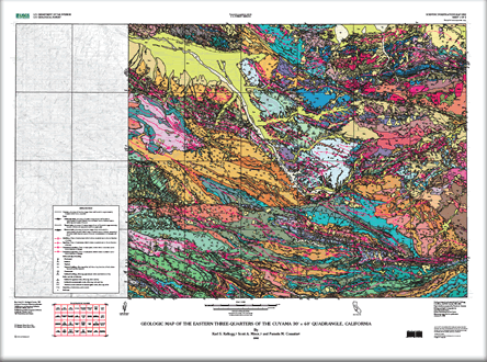
Kellogg, K.S., Minor, S.A., and Cossette, P.M., 2008, Geologic Map of the Eastern Three-Quarters of the Cuyama 30’ x 60’ Quadrangle, California: U.S. Geological Survey Scientific Investigations Map 3002, scale 1:100,000, 2 plates, 1 pamphlet, 23 p.
Background
Note on Marine Transgressions and Unconformities South of the San Andreas Fault
Description of Map Units
Rocks South of the San Andreas Fault Zone
Rocks South of Big Pine and Pine Mountain Faults (Domain 1)
Rocks West of Cuyama River and North of Big Pine Fault (Domain 2)
Rocks of the Caliente Hills (Domain 3)
Rocks North of Pine Mountain Fault, East of Cuyama River, and South of San Andreas Fault (Domain 4)
Fault-Bounded Rocks of the San Andreas Fault Zone
Rocks North of the San Andreas Fault Zone
References

![]() U.S. Department of the Interior | U.S. Geological Survey
U.S. Department of the Interior | U.S. Geological Survey
URL: http://pubsdata.usgs.gov/pubs/sim/3002/index.html
Questions or Assistance: Contact USGS
Last modified: Thursday, 01-Dec-2016 17:09:59 EST