Scientific Investigations Map 3020
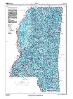
ABSTRACTThe U.S. Geological Survey, in cooperation with the Mississippi Department of Environmental Quality, U.S. Department of Agriculture-Natural Resources Conservation Service, Mississippi Department of Transportation, U.S. Department of Agriculture-Forest Service, and the Mississippi Automated Resource Information System developed a 1:24,000-scale Watershed Boundary Dataset for Mississippi including watershed and subwatershed boundaries, codes, names, and areas. The Watershed Boundary Dataset for Mississippi provides a standard geographical framework for water-resources and selected land-resources planning. The original 8-digit subbasins (Hydrologic Unit Codes) were further subdivided into 10-digit watersheds (62.5 to 391 square miles (mi2)) and 12-digit subwatersheds (15.6 to 62.5 mi2)—the exceptions being the Delta part of Mississippi and the Mississippi River inside levees, which were subdivided into 10-digit watersheds only. Also, large water bodies in the Mississippi Sound along the coast were not delineated as small as a typical 12-digit subwatershed. All of the data—including watershed and subwatershed boundaries, subdivision codes and names, and drainage-area data—are stored in a Geographic Information System database, which are available at: http://ms.water.usgs.gov/. This map shows information on drainage and hydrography in the form of U.S. Geological Survey hydrologic unit boundaries for water-resource 2-digit regions, 4-digit subregions, 6-digit basins (formerly called accounting units), 8-digit subbasins (formerly called cataloging units), 10-digit watershed, and 12-digit subwatersheds in Mississippi. A description of the project study area, methods used in the development of watershed and subwatershed boundaries for Mississippi, and results are presented in Wilson and others (2008). The data presented in this map and by Wilson and others (2008) supersede the data presented for Mississippi by Seaber and others (1987) and U.S. Geological Survey (1977). |
First posted December 11, 2009
SIM 3020 presents information on drainage and hydrography in the form of U.S. Geological Survey hydrologic unit boundaries for water-resource 2-digit regions, 4-digit subregions, 6-digit basins, 8-digit subbasins, 10-digit watershed, and 12-digit subwatersheds in Mississippi. The methods used in the development of watershed and subwatershed boundaries for Mississippi are presented in OFR 2008-1198. Table 1 of the report lists the 8-digit subbasin, 10-digit watershed, and 12-digit subwatershed codes, names, and drainage area sizes in an Excel spreadsheet. For additional information contact: Part or all of this report is presented in Portable Document Format (PDF); the latest version of Adobe Reader or similar software is required to view it. Download the latest version of Adobe Reader, free of charge. |
Wilson, K.V., Jr., Clair, M.G. II, Turnipseed, D.P., and Rebich, R.A., 2009, Watershed Boundary Dataset for Mississippi: U.S. Geological Survey Scientific Investigations Map 3020, scale 1:500,000.

![]() U.S. Department of the Interior |
U.S. Geological Survey
U.S. Department of the Interior |
U.S. Geological Survey
URL: http://pubsdata.usgs.gov/pubs/sim/3020/index.html
Page Contact Information: USGS Publications Team
Page Last Modified: Thursday, 01-Dec-2016 17:17:58 EST
