Scientific Investigations Map 3111
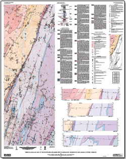
IntroductionThe bedrock geology of the Montpelier and Barre West quadrangles consists of Silurian and Devonian metasedimentary rocks of the Connecticut Valley-Gaspé synclinorium (CVGS) and metasedimentary, metavolcanic, and metaintrusive rocks of the Cambrian and Ordovician Moretown and Cram Hill Formations. Devonian granite dikes occur throughout the two quadrangles but are more abundant in the Silurian and Devonian rocks. The pre-Silurian rocks are separated from the rocks of the CVGS by the informally named “Richardson Memorial Contact,” historically interpreted as either an unconformity or a fault. The results of this report represent mapping by G.J. Walsh, Jonathan Kim, and M.H. Gale from 2002 to 2005. S.M. King assisted Kim and Gale from 2002 to 2003. A.M. Satkoski (Indiana University) assisted Walsh, and L.R. Pascale (University of Vermont) and C.M. Orsi (Middlebury College) assisted Kim and Gale as summer interns in 2003. This study was designed to map the bedrock geology in the area. This map supersedes a preliminary map of the Montpelier quadrangle (Kim, Gale, and others, 2003). A companion study in the Barre West quadrangle (Walsh and Satkoski, 2005) determined the levels of naturally occurring radioactivity in the bedrock from surface measurements at outcrops during the course of 1:24,000-scale geologic mapping to identify which rock types were potential sources of radionuclides. Results of that study indicate that the carbonaceous phyllites in the CVGS have the highest levels of natural radioactivity. This report consists of a map, text pamphlet, and GIS database. The map and text pamphlet are available in paper format or as downloadable files (see frame at right). The GIS database is available for download. |
Posted September 2010
For additional information, please contact Gregory Walsh. Part or all of this report is presented in Portable Document Format (PDF); the latest version of Adobe Reader or similar software is required to view it. Download the latest version of Adobe Reader, free of charge. |
Walsh, G.J., Kim, Jonathan, Gale, M.H., and King, S.M., 2010, Bedrock geologic map of the Montpelier and Barre West quadrangles, Washington and Orange Counties, Vermont: U.S. Geological Survey Scientific Investigations Map 3111, 1 sheet, scale 1:24,000, 36-p. text, also available at https://pubs.usgs.gov/sim/3111.

![]() U.S. Department of the Interior |
U.S. Geological Survey
U.S. Department of the Interior |
U.S. Geological Survey
[an error occurred while processing this directive]
URL: https://pubsdata.usgs.gov
Page Contact Information: Contact USGS
Page Last Modified: Thursday, December 01 2016, 05:20:10 PM
