Scientific Investigations Map 3171
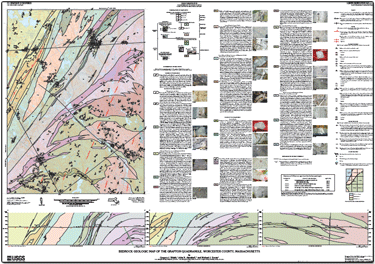
IntroductionThe bedrock geology of the 7.5-minute Grafton, Massachusetts, quadrangle consists of deformed Neoproterozoic to early Paleozoic crystalline metamorphic and intrusive igneous rocks. Neoproterozoic intrusive, metasedimentary, and metavolcanic rocks crop out in the Avalon zone, and Cambrian to Silurian intrusive, metasedimentary, and metavolcanic rocks crop out in the Nashoba zone. Rocks of the Avalon and Nashoba zones, or terranes, are separated by the Bloody Bluff fault. The bedrock geology was mapped to study the tectonic history of the area and to provide a framework for ongoing hydrogeologic characterization of the fractured bedrock of Massachusetts. This report presents mapping by G.J. Walsh, geochronology by J.N. Aleinikoff, geochemistry by M.J. Dorais, and consists of a map, text pamphlet, and GIS database. The map and text pamphlet are available in paper format or as downloadable files (see frame at right). The GIS database is available for download. The database includes contacts of bedrock geologic units, faults, outcrops, structural geologic information, and photographs. |
Posted February 24, 2012
For additional information contact: Part or all of this report is presented in Portable Document Format (PDF); the latest version of Adobe Reader or similar software is required to view it. Download the latest version of Adobe Reader, free of charge. |
Walsh, G.J., Aleinikoff, J.N., and Dorais, M.J., 2011, Bedrock geologic map of the Grafton quadrangle, Worcester County, Massachusetts: U.S. Geological Survey Scientific Investigations Map 3171, 1 sheet, scale 1:24,000, 39-p. text.
Introduction
Stratigraphy
U-Pb Geochronology
Methods
Results
Ponaganset Gneiss (Zpg)
Northbridge Granite Gneiss (Zncg)
Hope Valley Alaskite Gneiss (Zhvb and Zhv)
Grafton Gneiss (Єgg)
Marlboro Formation—Amphibolite (Єm)
Geochemistry
Methods
Results
Structural Geology
Ductile Structures
First-Generation Foliation—D1 Deformation
Second-Generation Foliation—D2 Deformation
Third-Generation Foliation—D3 Deformation
Ductile Faults
Spencer Brook and Assabet River Faults
Bloody Bluff Fault
Burlington Mylonite Zone
Fisherville Pond Fault
Comment on the Hope Valley Shear Zone
Brittle Structures
Brittle Faults
Metamorphism
Acknowledgments
References Cited

![]() U.S. Department of the Interior |
U.S. Geological Survey
U.S. Department of the Interior |
U.S. Geological Survey
URL: http://pubsdata.usgs.gov/pubs/sim/3171/index.html
Page Contact Information: GS Pubs Web Contact
Page Last Modified: Thursday, 01-Dec-2016 17:24:32 EST
