Scientific Investigations Map 3232
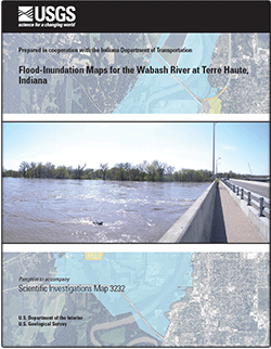
AbstractDigital flood-inundation maps for a 6.3-mi reach of the Wabash River from 0.1 mi downstream of the Interstate 70 bridge to 1.1 miles upstream of the Route 63 bridge, Terre Haute, Indiana, were created by the U.S. Geological Survey (USGS) in cooperation with the Indiana Department of Transportation. The inundation maps, which can be accessed through the USGS Flood Inundation Mapping Science Web site at http://water.usgs.gov/osw/flood_inundation/, depict estimates of the areal extent of flooding corresponding to select water levels (stages) at the USGS streamgage Wabash River at Terre Haute (station number 03341500). Current conditions at the USGS streamgage may be obtained on the Internet from the USGS National Water Information System (http://waterdata.usgs.gov/in/nwis/uv/?site_no=03341500&agency_cd=USGS&p"). In addition, the same data are provided to the National Weather Service (NWS) for incorporation into their Advanced Hydrologic Prediction Service (AHPS) flood warning system (http://water.weather.gov/ahps//). Within this system, the NWS forecasts flood hydrographs for the Wabash River at Terre Haute that may be used in conjunction with the maps developed in this study to show predicted areas of flood inundation. In this study, flood profiles were computed for the stream reach by means of a one-dimensional step-backwater model. The model was calibrated using the most current stage-discharge relation at the Wabash River at the Terre Haute streamgage. The hydraulic model was then used to compute 22 water-surface profiles for flood stages at 1-ft interval referenced to the streamgage datum and ranging from bank-full to approximately the highest recorded water level at the streamgage. The simulated water-surface profiles were then combined with a geographic information system digital elevation model (derived from Light Detection and Ranging (LiDAR) data having a 0.37-ft vertical accuracy and a 1.02-ft horizontal accuracy) to delineate the area flooded at each water level. The availability of these maps along with Internet information regarding the current stage from the USGS streamgage and forecasted stream stages from the NWS can provide emergency management personnel and residents with information that is critical for flood response activities such as evacuations and road closures as well as for post flood recovery efforts. |
First posted September 5, 2013
For additional information contact: Part or all of this report is presented in Portable Document Format (PDF); the latest version of Adobe Reader or similar software is required to view it. Download the latest version of Adobe Reader, free of charge. |
Lombard, P.J., 2013, Flood-inundation maps for the Wabash River at Terre Haute, Indiana: U.S. Geological Survey Scientific Investigations Map 3232, 22 sheets, 7-p. pamphlet, https://pubs.usgs.gov/sim/3232/.
Acknowledgments
Abstract
Introduction
Constructing Water-Surface Profiles
Inundation Mapping
Summary
References Cited

![]() U.S. Department of the Interior |
U.S. Geological Survey
U.S. Department of the Interior |
U.S. Geological Survey
URL: http://pubsdata.usgs.gov/pubs/sim/3232/index.html
Page Contact Information: GS Pubs Web Contact
Page Last Modified: Thursday, 01-Dec-2016 17:30:54 EST
