 Abstract Abstract
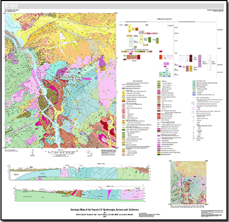
The Topock quadrangle exposes a structurally complex part of the Colorado River extensional corridor and also exposes deposits that record landscape evolution during the history of the Colorado River. Paleoproterozoic gneisses and Mesoproterozoic granitoids and intrusive sheets are exposed through tilted cross-sectional thicknesses of many kilometers. Intruding them are a series of Mesozoic to Tertiary igneous rocks including dismembered parts of the Late Cretaceous Chemehuevi Mountains Plutonic Suite. Plutons of this suite in Arizona, if structurally restored for Miocene extension, formed cupolas capping the Chemehuevi Mountains batholith in California. Thick (1–3 km) Miocene sections of volcanic rocks, sedimentary breccias, conglomerate, and sandstone rest nonconformably on the Proterozoic rocks and record the structural and depositional evolution of the Colorado River extensional corridor. Four major Miocene low-angle normal faults and a steep block-bounding fault that developed during this episode divide the deformed rocks of the quadrangle into major structural plates and tilted blocks in and east of the Chemehuevi Mountains core complex. The low-angle faults attenuate crustal section, superposing supracrustal and upper crustal rocks against gneisses and granitoids originally from deeper crustal levels. The transverse block-bounding Gold Dome Fault Zone juxtaposes two large hanging-wall blocks, each tilted 90°, and the fault zone splays at its tip into folds in layered Miocene rocks. A synfaulting intrusion occupies the triangular zone where the folded strata detached from an inside corner along this fault between the tilt blocks. Post-extensional upper Miocene to Quaternary strata, locally deformed, record post-extensional landscape evolution, including several Pliocene and younger aggradational episodes in the Colorado River valley and intervening degradation episodes. The aggradational sequences include (1) the Bouse Formation, (2) fluvial deposits correlated with the alluvium of Bullhead City, (3) the younger fluvial boulder conglomerate of Bat Cave Wash, (4) the fluvial Chemehuevi Formation and related valley-margin deposits, and (5) fluvial Holocene deposits under the river and the valley floor. These fluvial records of Colorado River deposition are interspersed with piedmont alluvial fan deposits of several ages.
|
First posted January 31, 2013
Data:
- Readme TXT (1 kB)
- Metadata TXT (12 kB)
- GIS database ZIP (topock_db.zip, 4.9 MB, compressed; expands to topock_db, 13.7 MB) Zipped package includes the map base, style, geodatabase, and readme.
- Shapefiles ZIP (topock_shape.zip, 4.5 MB, compressed; expands to topock_shape, 10.8 MB) Zipped package expands to include the map base, style, shapefiles derived from the geodatabase feature classes, and readme.
-
This report is available only on the Web.
|

